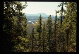
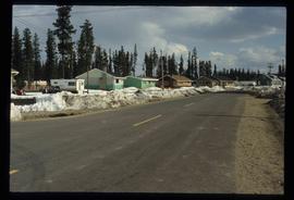
Mostrando 4951 resultados

Archival description
3026 resultados con objetos digitales Muestra los resultados con objetos digitales
P.G. Plan
2012.13.1.001 · Sub-séries · [between 1985 and 2003]
Parte de J. Kent Sedgwick fonds

File contains slides depicting maps and site plans for the city of Prince George.

Sky
2012.13.1.3.004 · Item · Jan. 1971
Parte de J. Kent Sedgwick fonds

Image depicts the sky at either dusk or dawn, from an unknown location.

Highway 97
2012.13.1.3.022 · Item · Oct. 1975
Parte de J. Kent Sedgwick fonds

Image depicts Highway 97 at 15th Ave. looking north. Map coordinates 53°54'42.1"N 122°46'53.1"W

Trailers for Sale
2012.13.1.3.027 · Item · Oct. 1975
Parte de J. Kent Sedgwick fonds

Image depicts mobile homes for sale on Cowart Road looking northeast with Simon Fraser Bridge in background. Map coordinates 53°52'39.3"N 122°46'13.1"W

Woodwards
2012.13.1.3.029 · Item · Oct. 1975
Parte de J. Kent Sedgwick fonds

Image depicts Parkwood Place taken from Connaught Hill looking west with the hospital in the background. Map coordinates 53°54'39.9"N 122°45'02.5"W

Prince George
2012.13.1.3.042 · Item · Nov. 1977
Parte de J. Kent Sedgwick fonds

Image depicts downtown Prince George looking northwest across Dominion Street. Map coordinates 53°54'48.7"N 122°44'45.6"W

View from City Hall
2012.13.1.3.045 · Item · Jan. 1978
Parte de J. Kent Sedgwick fonds

Image depicts a view of Prince George from City Hall looking northeast with the pulp mills in the background. Map coordinates 53°54'46.3"N 122°44'41.9"W

View from Gunn Point
2012.13.1.3.058 · Item · Nov. 1979
Parte de J. Kent Sedgwick fonds

Image depicts a view of Prince George from Gunn Point in the L.C. Gunn Park looking north. Map coordinates 53°54'26.2"N 122°43'35.8"W.

View from Gunn Point
2012.13.1.3.062 · Item · Nov. 1979
Parte de J. Kent Sedgwick fonds

Image depicts a view of Prince George from Gunn Point in the L.C. Gunn Park looking north. Map coordinates 53°54'26.2"N 122°43'35.8"W.

View from Gunn Point
2012.13.1.3.063 · Item · Nov. 1979
Parte de J. Kent Sedgwick fonds

Image depicts a view of Prince George from Gunn Point in the L.C. Gunn Park looking north. Map coordinates 53°54'26.2"N 122°43'35.8"W.

View from Gunn Point
2012.13.1.3.066 · Item · Nov. 1979
Parte de J. Kent Sedgwick fonds

Image depicts a view of Prince George from Gunn Point in the L.C. Gunn Park looking north. Map coordinates 53°54'26.2"N 122°43'35.8"W.

View from Gunn Point
2012.13.1.3.067 · Item · Nov. 1979
Parte de J. Kent Sedgwick fonds

Image depicts a view of Prince George from Gunn Point in the L.C. Gunn Park looking north. Map coordinates 53°54'26.2"N 122°43'35.8"W.

Tabor Mountain
2012.13.1.3.068 · Item · Nov. 1979
Parte de J. Kent Sedgwick fonds

Image depicts a view of Prince George, from Gunn Point in the L.C. Gunn Park.

Downtown Prince George
2012.13.1.3.079 · Item · May 1984
Parte de J. Kent Sedgwick fonds

Image depicts downtown Prince George taken from City Hall looking northwest. Map coordinates 53°54'46.2"N 122°44'43.9"W

Beehive Burner
2012.13.1.3.089 · Item · 12 Oct. 1989
Parte de J. Kent Sedgwick fonds

Image depicts a Beehive Burner along the Nechako on River Road. Map coordinates 53°55'34.1"N 122°44'58.0"W.

Nechako Cutbanks Trail
2012.13.1.3.091 · Item · 12 Oct. 1989
Parte de J. Kent Sedgwick fonds

Image depicts the cutbanks on the other side of the Nechako, taken from the nature trail at Island Cache. Map coordinates 53°55'34.6"N 122°45'52.4"W

Downtown Prince George Businesses
2012.13.1.3.107 · Item · 12 Oct. 1989
Parte de J. Kent Sedgwick fonds

Image depicts 4th Ave at Brunswick St. and the following businesses: Hart Drugs, The Yarn Barn, and Saveco. Map coordinates 53°54'59.9"N 122°44'52.9"W

Downtown Prince George Businesses
2012.13.1.3.108 · Item · 12 Oct. 1989
Parte de J. Kent Sedgwick fonds

Image depicts 4th Ave at Quebec St, showing the following businesses: The Yarn Barn, Golden Chalice Jewellers, Dandy Lines, Ultrasport, and Saveco. Map coordinates 53°54'58.6"N 122°44'47.5"W

CN Train Yard
2012.13.1.3.121 · Item · 12 Oct. 1989
Parte de J. Kent Sedgwick fonds

Image depicts a number of trains in the CNR train yard taken from River Road in Prince George, B.C. Map coordinates 53°54'51.5"N 122°43'29.6"W

Prince George
2012.13.1.3.134 · Item · 12 Oct. 1989
Parte de J. Kent Sedgwick fonds

Image depicts Prince George, possibly with the Northwood Pulpmill in the background.

Wood Bridge and Snow Sculptures
2012.13.1.3.148 · Item · Apr. 1999
Parte de J. Kent Sedgwick fonds

Image depicts two snow sculptures near a wooden bridge on an ice rink, possibly during the Winter City Conference, in Prince George, B.C. Taken at the Prince George Civic Center. Map coordinates 53°54'45.6"N 122°44'59.6"W

Prince George Sawmill
2012.13.1.3.159 · Item · Nov. 2000
Parte de J. Kent Sedgwick fonds

Image depicts Prince George Sawmill taken from across the Nechako River looking southwest. Map coordinates 53°56'00.0"N 122°44'29.7"W

Third Avenue
2012.13.1.3.161 · Item · May 2001
Parte de J. Kent Sedgwick fonds

Image depicts 3rd Ave in Prince George, B.C. Map coordinates 53°55'01.9"N 122°44'48.7"W

Highway 97
2012.13.1.3.164 · Item · May 2001
Parte de J. Kent Sedgwick fonds

Image depicts a section of Highway 97 looking south. Map coordinates 53°55'10.3"N 122°46'54.9"W

Prince George Residential Area
2012.13.1.3.168 · Item · Mar. 2003
Parte de J. Kent Sedgwick fonds

Image depicts an aerial view of a Prince George residential section between Highway 97, Carney Street and 10th Ave looking north. Map coordinates 53°54'54.0"N 122°46'00.4"W

Bear
2012.13.1.4.02 · Item · Aug. 1976
Parte de J. Kent Sedgwick fonds

Image depicts a bear located at the Bear Lake Dump.

Red Rock (?)
2012.13.1.4.33 · Item · [2000?]
Parte de J. Kent Sedgwick fonds

Image depicts a road, forest, and hill rise in an uncertain location possibly near Red Rock, B.C.