Showing 441 results
Archival description
Universal Soil Loss Equation Calculator
Universal Soil Loss Equation Calculator
"Upper Dean River Local Resource Use Plan"
"Upper Dean River Local Resource Use Plan"
"Uranium Exploration Sites in BC"
"Uranium Exploration Sites in BC"
"Urban Growth and the Agricultural Land Reserve: Up not Out - Symposium Proceedings"
"Urban Growth and the Agricultural Land Reserve: Up not Out - Symposium Proceedings"
"Use and Management of Land on Valley Train Deposits"
"Use and Management of Land on Valley Train Deposits"

Van Bow Existing Land Use 1976

Van Bow Existing Land Use 1977

Van Bow Existing Zoning

Vancouver Carney Study
![Vancouver Carney Study [Existing Land Use]](/uploads/r/northern-bc-archives-special-collections-1/d/8/4/d841cd29016ddb96663d51e137bd7a3b7c4dfe3ec645baca199615e3e4464da3/2023.5.1.21a_-_Vancouver_and_Carney_Study_Area_Existing_Land_Use_JPG85_tb_142.jpg)
Vancouver Carney Study [Existing Land Use]
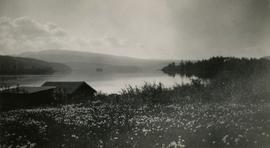
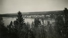
View of Burns Lake
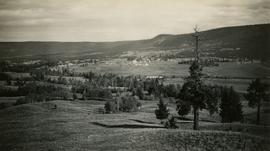
View of Fort St. James, with Mount Murray in the distant background
View of Fort St. James, with Mount Murray in the distant background
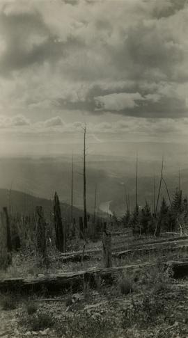
View of Fraser River from Fraser Mountain
View of Fraser River from Soda Creek hill in June
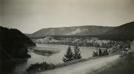
View of Fraser River from Soda Creek hill in October

View of Front Street and Quesnel Hotel from Fraser River Bridge in Quesnel
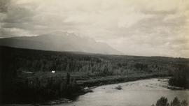
View of Hudson Bay Mountain from Telkwa water tower

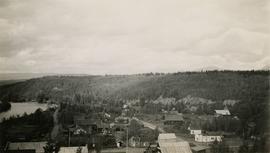
View of Prince George from east hill
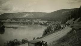
View of Quesnel and Fraser River Bridge

View of street down to the shore
View of Telkwa from water tower
View of Williams Lake from Chilcotin Road
Views of Prince Rupert, B.C.: its growth and development from 1908 to 1910
Views of Prince Rupert, B.C.: its growth and development from 1908 to 1910

Visual notes from the 2020 Public Health Summer Institute

VLA Lands

V.L.A. Proposed Zoning

V.L.A. Proposed Zoning as Recommended by Alderman A. Stauble, April 20, 1976

V.L.A. Proposed Zoning as Recommended by the City Planner, April 20, 1976

V.L.A. Record of Public Representations at Zoning Hearing, April 12, 1976
"Water Delivery by an Irrigation District"
"Water Delivery by an Irrigation District"
"Water Management in the Yukon Territory Integration with Land Use Planning"
"Water Management in the Yukon Territory Integration with Land Use Planning"
Wells Community Hall Repair and Refurbish Project
Wells Community Hall Repair and Refurbish Project
"Wells Gray Park Master Plan"
"Wells Gray Park Master Plan"
Wells Museum Building Fund
Wells Museum Building Fund
"Western Land Directors Conference Proceedings"
"Western Land Directors Conference Proceedings"
"Wilderness Tourism Association Strategic Plan"
"Wilderness Tourism Association Strategic Plan"
"Wildlife Habitat Mapping in British Columbia: Atlas of Inventories"
"Wildlife Habitat Mapping in British Columbia: Atlas of Inventories"
Workshop 2, Tape 2: 2:00 pm
Workshop 2, Tape 2: 2:00 pm
Workshop 2, Tape 3: 3:30 pm
Workshop 2, Tape 3: 3:30 pm
Workshop 2, Tape 5
Workshop 2, Tape 5
www.BCRock.com Expanded Version
www.BCRock.com Expanded Version