Item is an original copy of "Non-Farmland with Long Term Urban Potential in the Lower Mainland" by the BC Agricultural Land Commission.
Item is an original copy of "Non-Farmland with Long Term Urban Potential in the South Okanagan" by the BC Agricultural Land Commission.
Item is a copy of the "North American Water and Power Alliance (NAWAPA)" presentation to Cornell University Water Resources Center, Ithaca, New York by Roland P. Kelly, Edward R. Trapnell, and Ralph M. Parsons Company.
Item is a hand drawn and coloured map by the City of Prince George Planning Department depicting North Nechako neighbourhood area existing land use in 1976.
Item is a hand drawn and coloured map by the City of Prince George Planning Department depicting the North Nechako and Hart neighbourhood area proposed land use in 1976.
Item is a photocopied draft of the Northern Wetlands Research Project Final Report by P. Lynch-Stewart, B. Heli & D. Ouimet for Lands Directorate, Environment Canada.
Item is a newsletter entitled "Old Growth: What is at stake?".
Item is an original copy of "On Nature's Terms" by the Fur Institute of Canada.
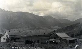
Photograph depicts a ranch home and barn along the road from Lillooet to Clinton. The location is believed to be a homestead 2 miles south of Pavilion Station. Two cars are parked beside the property, with a number of men nearby.
Item is an original BC Wild booklet entitled "Overcutting the Chilcotin: Putting at Risk Southern BC's Great Caribou Herd".
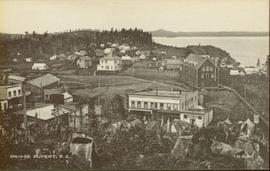
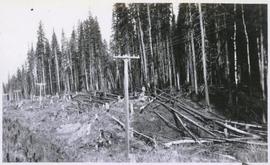
Wide angle photograph of many buildings scattered in a clear cut area. Foreground shows several businesses, including "Kelly Carruther's Supply" and "Prince Rupert Hardware and Supply Co." Some remaining forest is visible in the background. Annotation on recto reads: "Prince Rupert, BC 1659."
The item is a reproduction of a section of survey map drafted in 1915. The reproduction was likely created in 1990. The Plan Number is 1268 and highlights the area along the Nechako River. The map details subdivisions East of Carney Street and North of Fifth Avenue. Some original street and avenue names have been crossed out and replaced with handwritten names. Annotation on reverse side of map states, "D.L. 343 Pl. 1268."
Item is a map depicting a future high density development plan for the Peden Hill neighbourhood in Prince George.
Item is a map depicting a future low density development plan for the Peden Hill neighbourhood in Prince George.
Item is a map depicting a future medium density development plan for the Peden Hill neighbourhood in Prince George.
Item is a map depicting the areas of spring and fall shadow in the Peden Hill neighbourhood in Prince George.
Item is a map depicting the areas of winter shadow in the Peden Hill neighbourhood in Prince George.
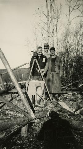
Photograph depicts (from left to right) Philip Monckton, Gordon Wyness, and Lavender Monckton at the Beaverly Geodetic Station, 7 miles west of Prince George. Surveying equipment (tripod, theodolite, and wire) are stationed at centre.
The item is a reproduction of a survey map likely drafted in the 1910s. The reproduction was likely created in 1990. The area covered is South of Anderson Street, East of Simpson Street, North of Van Bien Avenue and West of 9th Street. Annotations state, "Pl 721 DL 1426."
The item is a reproduction of a survey map drafted in July 1914. The reproduction was likely created in 1990. The area covered is along the Fraser River and east of Guelph Street. Annotations state, "PL 1409 D. L. 417 HBCo." and highlight different scales of measurement and changed street names.
The item is a reproduction of a survey map drafted on 29 Oct. 1910. The reproduction was likely created in 1990. The area covered is South of Princess Street, East of James Avenue, North of 8th Street and West of Rupert Avenue. Annotations state, "Jesse Hodgeson Crown grand in 1910 for $800..."
The item is a reproduction of a survey map drafted in 1 Oct. 1913. The reproduction was likely created in 1990. The area covered is along the Fraser River and west of Linooln Avenue, south of Jackson Street and North of McKinley Street. Annotations state which maps and lots are adjacent to this one. An illegible signature is highlighted.
The item is a reproduction of a survey map drafted on 1 March 1910. The reproduction was likely created in 1990. The area covered is South of Bernhardt Avenue, East of Simpson Street, North of the Fraser River and West of 9th Street. Annotations state, "DL 1426 Plan 721."
The item is a reproduction of a survey map drafted on 1 March 1910. The reproduction was likely created in 1990. The area highlighted is along the Fraser River. The map details subdivisions East of Ninth Street and South of Thapage Lane. Land Surveyor J. F. Templeton certified the plan. Annotation on the map states, "Pl. 727."
The item is a reproduction of a survey map drafted in 1909. The reproduction was likely created in 1990. The area covered are lots 931 and 417. Annotations state, "Plan 701," and various names are highlighted.
The item is a reproduction of a survey map likely drafted in the 1910s. The reproduction was likely created in 1990. The area covered is South of Baillie Street, East of 22nd Avenue, North of Princess Street and West of 7th Avenue. Annotations state, "Pl. 833" and various lot descriptions.
The item is a reproduction of a survey map drafted on 10 July 1956 and registered on 31 Oct. 1956. The reproduction was likely created in 1990. The plan number is 7782.
The item is a reproduction of a survey map drafted on 27 July 1910. The reproduction was likely created in 1990. The area covered is South of Reserve Avenue, East of Victoria, North of Bird Avenue and West of 9th Street. Annotations state, "#796" and highlight the date and registered owner.
Item is an original copy of "Planning for Agriculture" by Barry E. Smith, Policy Planner for the BC Provincial Agricultural Land Commission.
Item is an original copy of "Planning for Agriculture - Resource Materials" by Barry E. Smith, Policy Planner for the BC Provincial Agricultural Land Commission.
Item is a summary of Alastair McLean's thesis entitled "Plant Communities of the Similkameen Valley, British Columbia and their Relationships to Soils".
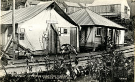
Photograph of post office and neighbouring building. Both buildings are composed of wood and tent materials. Annotation on recto reads: "Post Office & Customs House, Prince Rupert, BC."
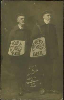
Photograph depicts two men posed with "CALGARY BEER" bags slung over shoulders. Handwritten annotation on verso of photograph: "Clark & Marchant Quebec to Vancouver on Foot", on recto: "To H F Glassey With Every Good wish. from Leo Marchant. Pearson's Magazine 1909."
3 duplicate copies available.
Item is an original copy of a 2002 promotional booklet produced by the BC Agricultural Land Commission entitled "Preserving Our Foodlands".
This fold out brochure, published by the Prince George Board of Trade, provides an overview of the industries present in Prince George by the BC Centennial; as well as a brief presentation of local recreational opportunities and a mileage listing.
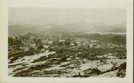
Wide angle photograph of Prince Rupert sometime during the winter. There is snow on the ground and a marge mountain range is visible in the background. Annotation on recto reads: "Prince Rupert looking East from Waterworks J.D.A Pho 5/2."
This commemorative souvenir was produced by the Prince Rupert Pioneers’ Association in 1914. Its content provides a textual overview of the individual persons who pioneered the establishment of Prince Rupert, as well as, their associated portrait photographs. This publication also provides a brief introduction to the history of Prince Rupert and includes some related historical photographs.
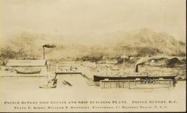
Photo of entire ship building plant, including several vessels in the foreground. Hills are visible in the background. Annotation on recto reads: "Prince Rupert Ship Repair and Ship Building Plant. Prince Rupert BC. Frank E Kirby, William T Donnelly, Engineers. 17 Battery Place. NYC."
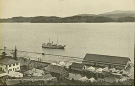
Photograph of a small vessel on the ocean with a dock and harbour buildings in the foreground. Tents and piles of lumber can be seen among the buildings. Annotation on recto reads: "The Wharf, Prince Rupert, BC. 1657." Printed annotation on verso reads "The Wharf, Prince Rupert, BC J. Howard A. Chapman, Victoria. BC. 1657."
Item is a reproduced typescript of a paper prepared for the 1968 annual meeting of the Association of BC Foresters in Kamloops by Dr. Peter Pearse. The paper is entitled "Principles for Allocating Wildland Among Alternative Uses".
Item is a 1960 Modern Land Policy journal reprint of an article by Howard Conklin entitled "Principles of Land Classification".
Item is an original copy of "Proceedings from the B.C. Land Use Strategy Workshop, Dunsmuir Lodge, Victoria" published by the Outdoor Recreation Council of British Columbia in 1988.
Item is an original copy of the "Proceedings of the Urban Issues, Opportunities and the Canadian Agriculture Industry Seminar" on November 3-7, 1998 organized by the Canadian Agriculture Lifetime Leadership Program.


