Map depicts the city of Prince George boundary expansions from 1913 to 1974.
A colour map produced by Industrial Reproduction Ltd. in Prince George. It illustrates maps of Hart Highway North, Blackburn Pineview Airport, and City of Prince George. It also includes a monthly calender from 1983.
16 blueprint plans produced by City of Prince George Engineering Department.
This map is part of Schedule B of the 1993 Official Community Plan, Bylaw No. 5909 for the City of Prince George. This particular map depicts the central area of the City of Prince George, including the Bowl area, the VLA, the Crescents, South Fort George, Heritage, and Peden Hill.
This map is part of Schedule B of the 1993 Official Community Plan, Bylaw No. 5909 for the City of Prince George. This particular map depicts the east area of the City of Prince George, including the Prince George Airport (YXS) and the Blackburn area.
This map is part of Schedule B of the 1993 Official Community Plan, Bylaw No. 5909 for the City of Prince George. This particular map depicts the northeast area of the City of Prince George, including the industrial areas on Prince George Pulpmill Road and Northwood Pulpmill Road along the Fraser River.
This map is part of Schedule B of the 1993 Official Community Plan, Bylaw No. 5909 for the City of Prince George. This particular map depicts the northwest area of the City of Prince George, including the North Nechako neighbourhood and the Hart.
This map depicts the City of Prince George's plan for soil removal and deposit.
This map is part of Schedule B of the 1993 Official Community Plan, Bylaw No. 5909 for the City of Prince George. This particular map reflects the 1998 amendment to the Official Community Plan.
This map is part of Schedule B of the 1993 Official Community Plan, Bylaw No. 5909 for the City of Prince George. This particular map reflects the 1998 amendment to the Official Community Plan.
This map is Schedule C of the 2001 Official Community Plan, Bylaw No. 7281 for the City of Prince George. This Schedule C map shows the long range land use for the City of Prince George.
This map is the May 2006 amendment (Bylaw 7807) of the Schedule C of the 2001 Official Community Plan, Bylaw No. 7281 for the City of Prince George. This Schedule C map shows the long range land use for the City of Prince George.
This map is the May 2008 amendment (Bylaw 8061) of the Schedule C of the 2001 Official Community Plan, Bylaw No. 7281 for the City of Prince George. This Schedule C map shows the long range land use for the City of Prince George.
This map is the October 2006 amendment (Bylaw 7807) of the Schedule C of the 2001 Official Community Plan, Bylaw No. 7281 for the City of Prince George. This Schedule C map shows the long range land use for the City of Prince George.
This map is the Schedule A accompanying map for the City of Prince George's Soil Removal and Deposit Bylaw No. 7022 of 1999. It depicts designated soil removal areas and M.O.T.H. gravel reserves.
This map is part of Schedule B of the 1993 Official Community Plan, Bylaw No. 5909 for the City of Prince George. This particular map depicts the southwest area of the City of Prince George, including College Heights, UNBC, University Heights, and Vanway.
File consists of photocopies and notes relating to the boundary expansions of the city of Prince George since its incorporation. Includes a graph drawn by Kent Sedgwick regarding the addition of land and water each year of the boundary expansion and a "Proclamation" photocopy from the B.C. Gazette (23 Apr. 1953). Also includes 5 maps: "City of Prince George Boundary Expansions since Incorporation in 1915" (1979 or 1980); "City of Prince George" (Feb. 1979); "Map of Prince George" (between 1970 and 1985); "Study Area Boundaries" (Mar. 1977); and "City of Prince George" (Feb. 1972).
Map depicts boundaries of study areas, including major study area, community study area, and the city of Prince George boundaries.
Map depicts the city of Prince George Boundary expansions since incorporation in 1915.
File consists of several sheets of handwritten notes regarding different bylaw developments. Includes newspaper clippings, a zoning bylaw summary and update, and a request for input from the Current Planning and Development Division of the City of Prince George.
File consists of a bylaw for the City of Prince George to establish zoning. Includes a regional index of the Prince George area.
File consists of clippings, letters, notes, and reproductions relating to the development and use of a coat of arms for the city of Prince George. Includes: "Coat of arms committee minutes" (9 Dec. 1994); printed photos of the proposed coat of arms and flag for the city of Prince George (Jan. 1995); "Ceremony for the Presentation of Armorial Bearings and Letters Patent to the City of Prince George" (29 July 1996); an invitation from the office of the mayor (29 July 1996); "Proposed armorial bearings for the city of Prince George"; "Symbolism in the armorial bearings of Prince George, B.C". (12 May 1995); and "The Canada Chart". Also includes a poster entitled "The Canada Chart". Includes the following clipped articles from the Prince George Citizen newspaper: "Coat of arms tell own story"; "City, CNC join old tradition" (30 July 1996); "Coat of arms carved for chamber" (19 Nov. 1996).
File consists of a second draft copy of a development cost charge review for the City of Prince George. Includes accompanying documents such as correspondence, newspaper clippings, handwritten notes and calculations, and a handout on development cost charge.
Compiled from Aerial Photography Taken September 23 1975. By Aero Geometrics LTD. New Westminister, B.C.
Compiled from Aerial Photography Taken September 23 1975. By Aero Geometrics LTD. New Westminister, B.C.
"Compiled from Aerial Photography Taken September 23 1975. By Aero Geometrics LTD. New Westminister, B.C."
Publications found within this file are:
City of Prince George, Financial Statement: For the Year Ended December 31, 1946; Bill. No. 20. 1946. Chap 27, Amended: An Act to Amend the "Electric power Act." Bill. No. 10. 1945. An Act to Provide for Improving the Availability and Supply of Electrical Power.
File consists of notes, reproductions, clippings, and letters relating to the Junkers aircraft named "The City of Prince George," registration CF-ALX. Includes: "Western Canada Aviation Museum" letter to Dennis McCallum from Karen Schmidt (25 June 1986) and "City of Prince George Junkers F-13 Airplane" typescript document (4 Sept. 1986).
Item is an original map depicting the city of Prince George and its parks and trails. The map was published by the City of Prince George Leisure Services.
Map depicts the City of Prince George in 1976, including the Fraser River, Nechacko River, Cariboo Highway, Carney St., and Patricia Blvd. where the electoral district boundary was proposed along for the two districts of Fort Nelson-Peace River and Prince George-Bulkley Valley.
A b&w plan, identifies 5th Ave, Gutter's, Cassiar St., and 3rd Ave. "Cassiar: 3rd - 5th Ave"
b&w plan which shows 5th Ave, Cassiar St., and 3rd Ave.
"Cassiar: 3rd - 5th Ave"
File consists of soil removal and deposit bylaw updates from 1982, 1996, and 1999 in Prince George. Includes a newspaper clipping on the adopted cost charge bylaw.
File consists of bylaw no. 7022 regarding soil removal and deposit in the City of Prince George.
Item is Map 2 of a group of five maps relating to a City of Prince George Study of Construction Aggregates by the firm Willis, Cunliffe, Tair & Company Limited. Map 2 shows development areas and aggregate requirements for 1984 and 1994. As the map is undated, it is unclear whether the 1984 and 1994 dates are future estimates.
Item is Map 1 of a group of five maps relating to a City of Prince George Study of Construction Aggregates by the firm Willis, Cunliffe, Tair & Company Limited. Map 1 shows development areas and population for 1984 and 1994. As the map is undated, it is unclear whether the 1984 and 1994 dates are future estimates.
Item is Map 4 of a group of five maps relating to a City of Prince George Study of Construction Aggregates by the firm Willis, Cunliffe, Tair & Company Limited. Map 4 shows development areas, aggregate sources, and requirements for 1984 and 1994. As the map is undated, it is unclear whether the 1984 and 1994 dates are future estimates.
Item is Map 5 of a group of five maps relating to a City of Prince George Study of Construction Aggregates by the firm Willis, Cunliffe, Tair & Company Limited. Map 5 shows drill hole locations.
Item is Map 3 of a group of five maps relating to a City of Prince George Study of Construction Aggregates by the firm Willis, Cunliffe, Tair & Company Limited. Map 3 shows geology of the Prince George area and known sources of construction aggregates.
File consists of two subdivision application guides and blank application forms.
File consists of subdivision control bylaw 3538 for the City of Prince George.
File consists of a timber inventory report by the Industrial Forestry Services Ltd. for the Regional District of Fraser-Fort George to determine the viability of a Tree Farm License.
File consists of zoning bylaw 3482 for the City of Prince George.
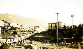
Photograph depicts a view of a walkway and slew, power poles, city buildings and mountains in the background. Handwritten annotation below photograph reads, "Portion of Rupert".
File contains correspondence between Brian Fawcett and the City of Toronto.
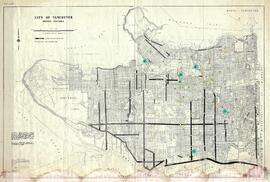
Map depicts the city of Vancouver, including the electoral districts of Comox-Powell River, Capilano, North Vancouver-Burnaby, Mission-Port Moody, Burnaby, Fraser Valley West, New Westminster-Coquitlam, Surrey-White Rock-North Delta, Richmond-South Delta, Vancouver South, Vancouver Kingsway, Vancouver Quadra, Vancouver Centre, and Vancouver East.
This municipal map of the City of Vancouver from 1987 shows street names and street widening information.


![City of Prince George - Schedule B of the Official Community Plan, Bylaw No. 5909 [1998 Amendment]](/uploads/r/northern-bc-archives-special-collections-1/d/6/d/d6d1c4e7e37fc948b97b3caa36447b52f7d2b76b13d45e3710aefee7b13840f0/2023.5.1.33_-_1998_Official_Community_Plan_City_of_PG_JPG85_tb_142.jpg)
![City of Prince George - Schedule B of the Official Community Plan, Bylaw No. 5909 [2001 Amendment]](/uploads/r/northern-bc-archives-special-collections-1/c/3/6/c36392b90696286cc6281e8cc2efbf7691c2617726495fa28db2cbdcc20e4e4c/2023.5.1.36_-_Official_Community_Plan_City_of_PG_Schedule_B_2001_JPG85_tb_142.jpg)

![City of Prince George - Schedule C of the Official Community Plan - Long Range Land Use Map [May 2006 Amendment]](/uploads/r/northern-bc-archives-special-collections-1/6/5/5/65536bc04aa97580c140131651dc357dfe5c3a1315822394f388d96940bc39cb/2023.5.1.39_-_2006_May_-_City_of_Prince_George_Long_Range_Land_Use_Map_JPG85_tb_142.jpg)
![City of Prince George - Schedule C of the Official Community Plan - Long Range Land Use Map [May 2008 Amendment]](/uploads/r/northern-bc-archives-special-collections-1/4/3/a/43a9e75941f1542735d999de340307d163e79dffdadbf4546bb9346b63f7e734/2023.5.1.41_-_2008_May_-_City_of_Prince_George_Long_Range_Land_Use_Map_JPG85_tb_142.jpg)
![City of Prince George - Schedule C of the Official Community Plan - Long Range Land Use Map [October 2006 Amendment]](/uploads/r/northern-bc-archives-special-collections-1/6/d/6/6d643c10801eba2ac493689972e57429dba42ec7592f54cb55151b96362d7048/2023.5.1.40_-_2006_Oct_-_City_of_Prince_George_Long_Range_Land_Use_Map_JGP85_tb_142.jpg)


