Item is a hand drawn and coloured map by the City of Prince George Planning Department depicting the Blackburn neighbourhood development area's proposed sector plan in 1976.
Item consists of interview with Walter Gill who discusses his career in the BC Provincial Police in Central Interior. Also talks about trapping in region.
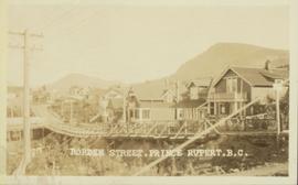
Harkins, BobWide angle view of Borden Street in Prince Rupert. Many residential buildings line the wooden road with railing. Printed annotation on recto reads: "Borden Street. Prince Rupert B.C."
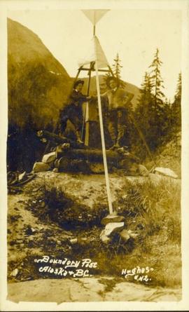
Photograph of two men posing next to a four-legged post erected in the wilderness. Printed annotation on recto reads: "Boundery[sic] Post Alaska & BC. Hughes #42."
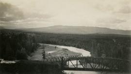
Photograph depicts two bridges crossing the Telkwa River. Wyness notes (on photograph verso) that this is where their survey crew traversed the river; he also noted erosion in the area.
Item is issue Vol. 2 No. 4 from February 1912 of the "British Columbia Bulletin of Information", a promotional mouthpiece of the Natural Resources Security Company. The publication is self-described as "About the vast natural resources and commercial, agricultural and mining progress, together with a synopsis of the laws regulating public lands, timber, coal and other minerals, and current record of development in British Columbia, Alberta and Saskatchewan for the business man, the farmer and the investor". The headline of this issue is "B.C. Government Guarantees Bonds of Railway to connect Fort George with Vancouver". The Natural Resources Security Company was a development company that sold a significant amount of land in Fort George.
Item is a photocopied version of "British Columbia Cross Country Ski Area Study" prepared by Nordic Group International under Canada-British Columbia Tourism Industry Development Subsidiary Agreement.
Item is an original report by the BC Min. of Agriculture, Fisheries and Food entitled "British Columbia Grains and Seeds Strategy: An Industry Development Plan".
Item is an original typescript of "British Columbia Recreation Sector Analysis East Kootenay Intersector Evaluation" by the Canada Land Inventory (ARDA) Recreation Sector, led by W.C. Yeomans.
Item is a photocopied version of "British Columbia Snowmobile Area Inventory Study" prepared by BC Snowmobile Federation for the BC Ministry of Tourism.
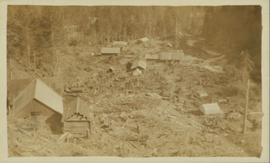
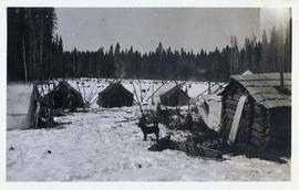
Photograph is a printed postcard depicting scattered small buildings and a tent. Trees have been removed from the area around the buildings and many stumps remain.
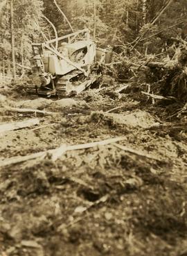
Photograph depicts a bulldozer clearing land for road making north of Stuart Lake.
The publication is a commemorative newsletter for the 180th Birthday celebration of Fort St. James. The publication was created by the Fort St. James Chamber of Commerce as a supplement to the Caledonia Courier. The publication also depicts the early pioneers of Fort St. James.
Item is a copy of "Campbell River Area Park Plan" by the Regional District of Comox Strathcona.
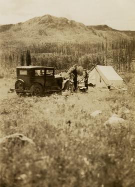
Photograph depicts (from left to right) Gordon Wyness and Jack Lee at their campsite at Sheraton. This location may reference the small community east of Burns Lake on the Canadian National Railway line. Wyness notes that "Sherton" [Sheraton?] Mountain is visible in the background of the photograph; the current name of that geographical feature could not be determined. The survey crew's car and tent are also visible in the image.
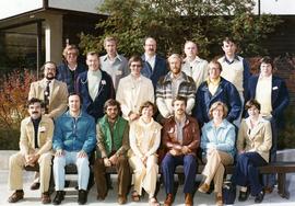
Photograph is a group portrait of the Canada Land Inventory team , possibly related to the National Soil Survey. Individuals identified: Norm Sprout (back row, 5th from left); Les Lavkulich (back row, 6th from left); Dr. Charlie Rowles (back row, 6th from right); Pat Duffy (3rd row back, 6th from right); Gary Runka (3rd row back, 5th from right).
Item is a pamphlet entitled "Canada Land Use Monitoring Program (CLUMP)".
Photograph is a group portrait of the attendees at a Canada National Land Use meeting. Back row, left to right: Gary Runka, Bruce Chambers, Frank Heaps, Vern Spencer, Peter Whiting. Middle row, left to right: Bob Scace, Lee Munn, Bill Bourgeois, Jim Murphy, Gerry Acott, Dave Rochefort. Front row, left to right: Mike Simmons, Les Cooke, John Hetherington, Betty McGregor, Daniel Paquette, Peggy Thompson, Patsy Murphy.
Item is an original copy of "Canada's Environment: An Overview" by Environment Canada.
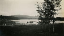
Photograph depicts the Canadian Airways Ltd Fairchild 71C CF-AWV float airplane at the shore of Burns Lake. The float plane was serving as a photography plane.
Item is a draft of "Cariboo Forest Region Resource Inventory Database".
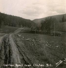
Photograph depicts the Cariboo Road near Clinton, B.C.
Item is a draft of "Cariboo-Chilcotin Grasslands Strategy: Interim Report on Grassland Encroachment and In-growth".
Item is a photocopied copy of the 1992 "Cariboo-Chilcotin Tourism Resource Inventory Study: Explanatory Notes" prepared by Ethos Consulting, G.G. Runka Land Sense Ltd. and Bioquest International Consulting Ltd. for BC Ministry of Tourism and Culture, Cariboo-Chilcotin Region.
Item is an original BC Wild booklet entitled "Cassiar: British Columbia's Fragile and Imperiled Northern Wilderness".
Item is an original copy of the presentation booklet "Celebrating 35 Years of the Agricultural Land Reserve: 1973-2008" created by Farmland Defence League of BC for an anniversary event. Includes an article by G. Gary Runka entitled "BC's Agricultural Land Reserve - Its Historical Roots".
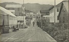
Photograph of residents in motion on Centre Street in Prince Rupert. Buildings are visible on either side of the street and a railway track runs down the length of the road. Annotation on recto reads: "Centre Street, Prince Rupert, BC. 1664."
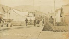
Street view of Centre Street in Prince Rupert, BC. Buildings are in various states of construction. Printed annotation on recto reads: "Centre St Prince Rupert B.C. June 20/08 JDA.""
Item is an original copy of "Charlotte-Alplands SRDZ Forest Recreation and Wilderness Tourism Opportunities" prepared by G.G. Runka Land Sense Ltd. et al. for the Anahim Round Table and Forest Renewal BC.
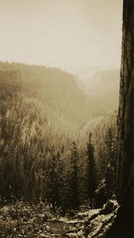
Photograph depicts "The Chasm" or "The Painted Chasm", located 11 miles north of Clinton, adjacent to the route of the Cariboo Road. In 1940, four years after this photograph was taken, Chasm Provincial Park was created in 1940 to preserve and promote the Painted Chasm feature, a gorge created from melting glacial waters eroding a lava plateau over a 10 million year span.
Photograph depicts "The Chasm" or "The Painted Chasm", located 11 miles north of Clinton, adjacent to the route of the Cariboo Road. In 1940, four years after this photograph was taken, Chasm Provincial Park was created in 1940 to preserve and promote the Painted Chasm feature, a gorge created from melting glacial waters eroding a lava plateau over a 10 million year span.
This map is part of Schedule B of the 1993 Official Community Plan, Bylaw No. 5909 for the City of Prince George. This particular map depicts the central area of the City of Prince George, including the Bowl area, the VLA, the Crescents, South Fort George, Heritage, and Peden Hill.
This map is part of Schedule B of the 1993 Official Community Plan, Bylaw No. 5909 for the City of Prince George. This particular map depicts the east area of the City of Prince George, including the Prince George Airport (YXS) and the Blackburn area.
This map is part of Schedule B of the 1993 Official Community Plan, Bylaw No. 5909 for the City of Prince George. This particular map depicts the northeast area of the City of Prince George, including the industrial areas on Prince George Pulpmill Road and Northwood Pulpmill Road along the Fraser River.
This map is part of Schedule B of the 1993 Official Community Plan, Bylaw No. 5909 for the City of Prince George. This particular map depicts the northwest area of the City of Prince George, including the North Nechako neighbourhood and the Hart.
This map depicts the City of Prince George's plan for soil removal and deposit.
This map is part of Schedule B of the 1993 Official Community Plan, Bylaw No. 5909 for the City of Prince George. This particular map reflects the 1998 amendment to the Official Community Plan.
This map is part of Schedule B of the 1993 Official Community Plan, Bylaw No. 5909 for the City of Prince George. This particular map reflects the 1998 amendment to the Official Community Plan.
This map is Schedule C of the 2001 Official Community Plan, Bylaw No. 7281 for the City of Prince George. This Schedule C map shows the long range land use for the City of Prince George.
This map is the May 2006 amendment (Bylaw 7807) of the Schedule C of the 2001 Official Community Plan, Bylaw No. 7281 for the City of Prince George. This Schedule C map shows the long range land use for the City of Prince George.
This map is the May 2008 amendment (Bylaw 8061) of the Schedule C of the 2001 Official Community Plan, Bylaw No. 7281 for the City of Prince George. This Schedule C map shows the long range land use for the City of Prince George.

![Canada Land Inventory National Soil Survey [?] group portrait](/uploads/r/northern-bc-archives-special-collections-1/4/b/6/4b63620d93fd801efb07b2dd93008b6f63d5d340f359bdabe11106ae8bb04dbe/2020_4_8_2_005_142.jpg)


![City of Prince George - Schedule B of the Official Community Plan, Bylaw No. 5909 [1998 Amendment]](/uploads/r/northern-bc-archives-special-collections-1/d/6/d/d6d1c4e7e37fc948b97b3caa36447b52f7d2b76b13d45e3710aefee7b13840f0/2023.5.1.33_-_1998_Official_Community_Plan_City_of_PG_JPG85_tb_142.jpg)
![City of Prince George - Schedule B of the Official Community Plan, Bylaw No. 5909 [2001 Amendment]](/uploads/r/northern-bc-archives-special-collections-1/c/3/6/c36392b90696286cc6281e8cc2efbf7691c2617726495fa28db2cbdcc20e4e4c/2023.5.1.36_-_Official_Community_Plan_City_of_PG_Schedule_B_2001_JPG85_tb_142.jpg)

![City of Prince George - Schedule C of the Official Community Plan - Long Range Land Use Map [May 2006 Amendment]](/uploads/r/northern-bc-archives-special-collections-1/6/5/5/65536bc04aa97580c140131651dc357dfe5c3a1315822394f388d96940bc39cb/2023.5.1.39_-_2006_May_-_City_of_Prince_George_Long_Range_Land_Use_Map_JPG85_tb_142.jpg)
![City of Prince George - Schedule C of the Official Community Plan - Long Range Land Use Map [May 2008 Amendment]](/uploads/r/northern-bc-archives-special-collections-1/4/3/a/43a9e75941f1542735d999de340307d163e79dffdadbf4546bb9346b63f7e734/2023.5.1.41_-_2008_May_-_City_of_Prince_George_Long_Range_Land_Use_Map_JPG85_tb_142.jpg)