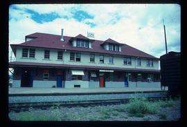
Mostrando 391 resultados

Archival description
352 resultados con objetos digitales Muestra los resultados con objetos digitales
Side of the Road
2012.13.1.78.64 · Item · 1982
Parte de J. Kent Sedgwick fonds

Image depicts a vehicled parked on the side of the road, with a view of the coast of Haida Gwaii in the background.

Sinclair Mills community hall
2012.13.1.135.5.06 · Item · 2010
Parte de J. Kent Sedgwick fonds

Photograph depicts the Sinclair Mills community hall, it includes a sign in front of the building reading "Welcome to Sinclair Mills, Community Hall".

Sinclair Mills Railway Tracks
2012.13.1.87.014 · Item · [between 1975 and 1995]
Parte de J. Kent Sedgwick fonds

Image depicts railway tracks and buildings with a beehive burner on the left. The location is likely Sinclair Mills, B.C. Map coordinates 54°01'17.4"N 121°40'53.0"W

Skiers and a Car
2012.13.1.129.14 · Item · 1975
Parte de J. Kent Sedgwick fonds

Image depicts a vehicle and a large group of skiers somewhere on Tabor Mountain in Prince George, B.C.

Snowy Road
2012.13.1.87.039 · Item · [between 1975 and 1995]
Parte de J. Kent Sedgwick fonds

Image depicts a road covered in snow running through the woods at an uncertain location.

Snowy Road
2012.13.1.87.103 · Item · [between 1975 and 1995]
Parte de J. Kent Sedgwick fonds

Image depicts a snowy road at an uncertain location.

Snowy Road and Houses
2012.13.1.87.011 · Item · [between 1975 and 1995]
Parte de J. Kent Sedgwick fonds

Image depicts a snow-covered road with vehicle tracks, and several houses. The location is uncertain.

Spirit Fishing Boat
2012.13.1.77.12 · Item · Aug. 1979
Parte de J. Kent Sedgwick fonds

Image depicts a fishing boat on the water somewhere near Prince Rupert, B.C. Only half of its name is visible: "spirit."

Star Capella
2012.13.1.77.14 · Item · Aug. 1979
Parte de J. Kent Sedgwick fonds

Image depicts a large vessel docked in Prince Rupert, B.C. The name on its side is "Star Capella." The slide itself is labelled "superport."

Stewart Access Road
2012.13.1.51.036 · Item · May 1973
Parte de J. Kent Sedgwick fonds

Image depicts a man, possibly Kent Sedgwick, leaning against a sign forbidding public traffic on the Stewart Access Road from between 5 am to 8 pm. Located in Hazelton, B.C.

Stewart Access Road - Warning Sign
2012.13.1.51.037 · Item · May 1973
Parte de J. Kent Sedgwick fonds

Image depicts an unknown individual leaning against a sign at the Stewart Access Road which warns travellers to pack several days of food. Located in Hazelton, B.C.

Street in Giscome - After
2012.13.1.87.094 · Item · [between 1980 and 2000]
Parte de J. Kent Sedgwick fonds

Image depicts a street in Giscome. The store was previously located on the left. The church is in the background. Map coordinates 54°04'18.5"N 122°21'57.7"W

Suspended Trailer
2012.13.1.122.09 · Item · Oct. 1975
Parte de J. Kent Sedgwick fonds

Image depicts a trailer for a logging truck suspended off the ground by a wooden structure. This is used to load the trailer onto the back of the truck. The name on the truck says "Rormarniewich Trucking Ltd."

The Duchess
2012.13.1.98.05 · Item · 1999
Parte de J. Kent Sedgwick fonds

Image depicts the Duchess engine, which was built in 1878 and taken out of service in 1919. It was part of a matched set with the Duke and is now a tourist attraction in Carcross, Y.T.

The Tutshi
2012.13.1.98.06 · Item · 1999
Parte de J. Kent Sedgwick fonds

Image depicts half of a ship, which is named the Tutshi, in Carcross, Y.T.

Train
2012.13.1.54.50 · Item · July 1980
Parte de J. Kent Sedgwick fonds

Image depicts a train in an uncertain location, though it is possibly Howe Sound in the background.

Train
2012.13.1.54.51 · Item · July 1980
Parte de J. Kent Sedgwick fonds

Image depicts a train in an uncertain location.

Train and Tracks
2012.13.1.82.20 · Item · 1980
Parte de J. Kent Sedgwick fonds

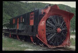
Image depicts the side of a train and the tracks it is on, somewhere in the Seton Portage area.

Train on Hansard Bridge
2012.13.1.89.137 · Item · 1999
Parte de J. Kent Sedgwick fonds

Image depicts a train on the Hansard Bridge across the Fraser River looking west. Map coordinates 54°04'37.7"N 121°50'39.9"W