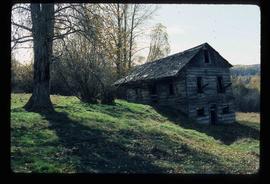
Imprimir vista previa Cerrar

Mostrando 3113 resultados

Archival description
Coastal Forest
2012.13.1.78.04 · Item · 1982
Parte de J. Kent Sedgwick fonds

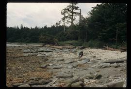
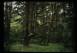
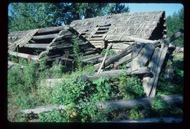
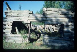
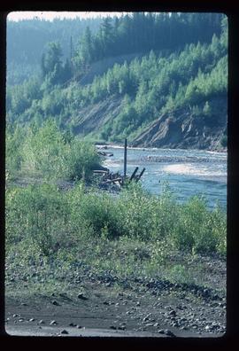
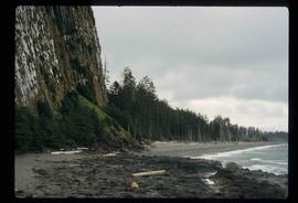
Image depicts the coastal forests on the shores of Haida Gwaii, B.C. An unknown individual is crouching on the beach in the image.

Collapsing Cabin
2012.13.1.13.16 · Item · Oct. 1984
Parte de J. Kent Sedgwick fonds

Image depicts an old, collapsing cabin somewhere in the Fort George Canyon Provincial Park, B.C.

Collison family fishing from dock
2009.7.1.293 · Item · [ca. 1880-1920]
Parte de Archdeacon W. H. Collison fonds

Members of the Collison family casually fishing from a large dock. Handwritten annotation on verso reads: "Collison family fishing from dock (Portland[?] Canal) {Max Elsie Henry Will Arthur Herbert}."

2011.3.3.89 · Item · [ca. 1909-1930]
Parte de North Coast & Central BC Postcard Collection

Photograph of a bridge along a rocky shoreline. Printed annotation reads: "Colloway Rapids Bridge Prince Rupert Highway W.W.W." Handwritten annotation on verso is heavily obscured by residual album paper and reads: "PO Box 777 Prince Rupert BC. [Illegible] Lal. This[??] is a piece of our new bridge which [obscured] neats our Island with the mainland. We have had picnics on the other side & [illegible] is open for [illegible] to [illegible]ve ours this side of the [obscured] our stuff to the little [obscured] patronize[??]. Mrs. [illegible] are back again in Rupert [obscured] Kamloops office closed down [obscured] was no chance of transfer. Have not."

2000.1.1.3.19.147 · Item · [ca. 1980]
Parte de Cassiar Asbestos Corporation Ltd. fonds

Photograph depicts Joseph wearing safety gear while standing at testing equipment on raised sampling station. Sign below Joseph reads "DO NOT DISTURB / SAMPLING IN PROGRESS / PROPERTY OF ENVIRONMENTAL CONTROL DEPT. / CASSIAR ASBESTOS LTD." Helen Joseph took air quality tests in the working areas and town (see item 2000.1.1.3.19.135). Power lines, unidentified building, and mountain base visible in background. Photo was taken during winter.

Community Album - Palletizer
2000.1.1.3.19.134 · Item · [ca. 1980]
Parte de Cassiar Asbestos Corporation Ltd. fonds

Photograph depicts palletizer machinery, where bags of asbestos fibre were shrink-wrapped and made ready for shipping pallets. Palletizer was located near shipping (believed to be in mill building). Unidentified man visible in machinery on far left.

2000.1.1.3.19.131 · Item · [ca. 1980]
Parte de Cassiar Asbestos Corporation Ltd. fonds

Photograph depicts machinery in snowy area of mine. Euclid ore haulage truck in foreground, cassiar pickup truck visible in lower area in midground. Blasthole drill in front of track shovel in left background, Wabco ore haulage truck visible behind other machinery in right background.

2000.1.1.3.19.129 · Item · [ca. 1980]
Parte de Cassiar Asbestos Corporation Ltd. fonds

Photograph depicts mine area. Switchback road and higher benches in background. Blasthole drills, track shovels, and ore haulage trucks can be seen on level in foreground and higher bench in background. Mountains visible in distance. Benches in background speculated to be located on the mine's West Peak.

2000.1.1.3.19.132 · Item · [ca. 1980]
Parte de Cassiar Asbestos Corporation Ltd. fonds

Photograph depicts part of the vacuum dust control and removal system in the Cassiar mill building. Unidentified man can be seen at rotary air-lock, in which heavy blown dust would collect before dropping to plenum conveyor resting just above floor. From here, the dust would eventually be expelled at the tailings pile outside of the mill. Second unidentified man can be seen climbing steps in background. This section of the mill was located above the lab.

Conveyor & Dump Truck at Gravel Pit
2000.1.1.3.18.012 · Item · June 1987
Parte de Cassiar Asbestos Corporation Ltd. fonds

Photograph depicts yellow conveyor belt in foreground over gravel pit, dump truck behind in midground. Mountains visible in background. Photo speculated to have been taken at the plant or near the Cassiar airstrip. Stamped annotation on recto of photograph: "JUN. 1987".

Cookhouse in Winter
2005.3.5 · Item · [ca. 1945]
Parte de John Hart Highway Photograph Collection

Handwritten caption beside this photo reads: "Cookhouse in Winter". Photograph depicts top of building semi-visible behind large snow pile. Treetops can be seen in background.

Cottonwood House
2012.13.1.126.49 · Item · [1990?]
Parte de J. Kent Sedgwick fonds

Image depicts the Cottonwood House Historic Site along Barkerville Highway, east of Quesnel, B.C. A sign posted by the fence reads: "For over half a century the Boyd family operated this haven for man and beast. Here weary travellers found lodging, food, and drink. Here fresh horses were hitched to stage-coaches and miners bought supplies. This historic road-house, built in 1864, stood as an oasis of civilization on the frontier of a rich new land."

Coulee Dam
2009.5.3.102 · Item · [ca 1930?]
Parte de Taylor-Baxter Family Photograph Collection

Photograph depicts large bridge and dam over a wide river, industrial structures throughout. Hills on opposite shore in background. Handwritten annotation on recto of photograph: "Coulee Dam, This is were[sic] I went this fall. Wished you had of been with me."

CPR SS Princess Charlotte
2009.7.1.269 · Item · [ca.1900-1908]
Parte de Archdeacon W. H. Collison fonds

Photograph of the SS "Princess Charlotte" on the open ocean. Metallic annotation on recto reads: "C.P.R.SS Princess Charlotte entered according to act of the parliament of Canada, in the year 1908[?]. by A. Shaw, at the Department of Agriculture." Printed annotation on verso reads "Shaw & Co., Photo. Victoria. B.C. (Empire Series)"

Creek
2012.13.1.31.16 · Item · 1985
Parte de J. Kent Sedgwick fonds

Image depicts a creek near Quesnelle Forks, B.C.