Print preview Close

Showing 54243 results

Archival description
21791 results with digital objects Show results with digital objects
2020.4.2.1.50 · File · Nov. 1980
Part of G. Gary Runka fonds

File consists of a speech given by Gary Runka entitled "Western Canadian Agriculture - A Look to the Future" for an unknown audience.

Commentary on this speech by Barry Smith of the Ministry of Agriculture and Lands:
"As the title suggests, this speech is largely a look at agriculture in Western Canada and therefore breaks from many of the familiar themes in GGR's speeches and includes several interesting statistics.

For example in 1921 the average Canadian farmer could feed 11 people. By 1981 the average farm could feed 56 people. [In 2012 The average farm in Canada produced enough food to feed 120 people every day.] The average Canadian expenditure of income on food after taxes:
1947 - 25%
1969 - 22%
1980 - 18%

The speech considers the following topics:
A. The changing Picture of Western Canadian Agriculture

  • Energy Costs
  • Cropping Options
  • Northern Expansion
  • Diversification, Intensification, Specialization
  • Foreign Ownership

B. Agricultural Land Use Planning
C. Integrated Land Use Issues"
Westcoast Review
1996.2.1.1.649 · File · 1986
Part of Brian Fawcett fonds

File contains correspondence to Brian Fawcett from Sandra Walton. Includes a letter to Brian Fawcett from Sandra Walton, Program Assistant/ Fine Arts and design at the Simon Fraser University, regarding a publication of the Westcoast Review. Letter dated January 7, 1986.

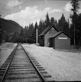
Westbridge CPR depot
2013.6.36.1.027.14 · Item · [July 1966]
Part of David Davies Railway Collection

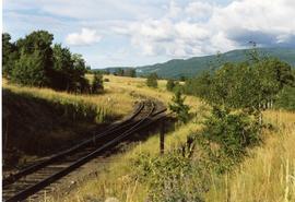
Photograph depicts the Westbridge CPR depot on the Kettle Valley Line. It is located about 11 miles north of Rock Creek and at about mile 123.3 east of Penticton. The depot house is disused and the sidings contained no cars, so there appears to be no local traffic.

2000.1.1.2.03.08 · Item · 8 August 1964
Part of Cassiar Asbestos Corporation Ltd. fonds

Handwritten annotation on recto of photograph: "FOOTING WEST WALL AUG 8/64." Photograph depicts a construction worker near freshly poured cement footings. Building is semi-visible in background on left, tall steel framework behind footings on right. The hard had of a second worker is visible behind footings.

2000.1.1.2.03.09 · Item · 8 August 1964
Part of Cassiar Asbestos Corporation Ltd. fonds

Handwritten annotation on recto of photograph: "WEST WALL FOOTING AUG 8/64." Photograph depicts a construction worker standing on rebar in forms built for cement footings. A front end loader and backhoe tractor can be seen on wood platform above footings. Mountainside in background.

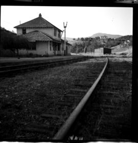
West Summerland CPR station
2013.6.36.1.022.14 · Item · 2 Sept. 1970
Part of David Davies Railway Collection

Photograph depicts the West Summerland CPR station in the Okanagan. The station often was used but not permanently manned. It was located at mile 9.5 from Penticton. The view is looking south.

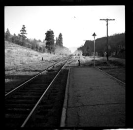
West Summerland CPR station
2013.6.36.1.022.15 · Item · 2 Sept. 1970
Part of David Davies Railway Collection

Photograph depicts the West Summerland CPR station in the Okanagan, located 9.5 miles from Penticton. The cloud in the middle distance is stone dust from a crusher on the east side of the track. The spur to the right leads to an old crusher but does not appear to be used.

2023.2.2.13.2.08 · Item · 8 Jul. 2007
Part of Dr. Paul Sanborn fonds

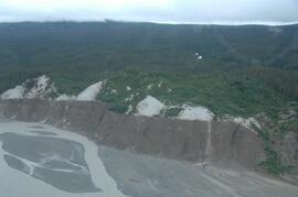
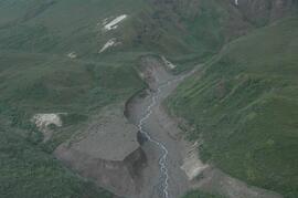
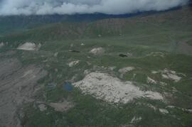
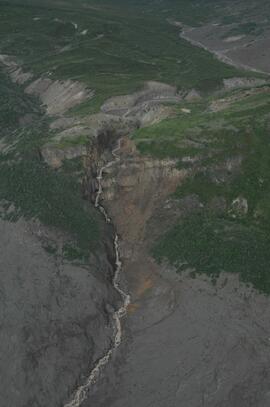
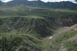
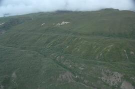
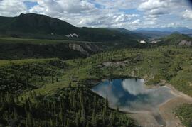
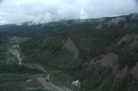
This image is part of the outbound sequence of aerial images obtained on the helicopter flight to the Klutlan Glacier study site. The sequence starts from the base camp at the White River crossing on the Alaska Highway and heads south, to a point just upvalley of the debris-covered terminus (approx. 10-15 km from Alaska border), and turning back north to the landing spot on the Generc River floodplain close to the study site (see Fig. 1 in paper).

2023.2.2.13.2.09 · Item · 8 Jul. 2007
Part of Dr. Paul Sanborn fonds

This image is part of the outbound sequence of aerial images obtained on the helicopter flight to the Klutlan Glacier study site. The sequence starts from the base camp at the White River crossing on the Alaska Highway and heads south, to a point just upvalley of the debris-covered terminus (approx. 10-15 km from Alaska border), and turning back north to the landing spot on the Generc River floodplain close to the study site (see Fig. 1 in paper).

2023.2.2.13.2.26 · Item · 8 Jul. 2007
Part of Dr. Paul Sanborn fonds

This image is part of the outbound sequence of aerial images obtained on the helicopter flight to the Klutlan Glacier study site. The sequence starts from the base camp at the White River crossing on the Alaska Highway and heads south, to a point just upvalley of the debris-covered terminus (approx. 10-15 km from Alaska border), and turning back north to the landing spot on the Generc River floodplain close to the study site (see Fig. 1 in paper).

2023.2.2.13.2.27 · Item · 8 Jul. 2007
Part of Dr. Paul Sanborn fonds

This image is part of the outbound sequence of aerial images obtained on the helicopter flight to the Klutlan Glacier study site. The sequence starts from the base camp at the White River crossing on the Alaska Highway and heads south, to a point just upvalley of the debris-covered terminus (approx. 10-15 km from Alaska border), and turning back north to the landing spot on the Generc River floodplain close to the study site (see Fig. 1 in paper).

2023.2.2.13.2.28 · Item · 8 Jul. 2007
Part of Dr. Paul Sanborn fonds

This image is part of the outbound sequence of aerial images obtained on the helicopter flight to the Klutlan Glacier study site. The sequence starts from the base camp at the White River crossing on the Alaska Highway and heads south, to a point just upvalley of the debris-covered terminus (approx. 10-15 km from Alaska border), and turning back north to the landing spot on the Generc River floodplain close to the study site (see Fig. 1 in paper).

2023.2.2.13.2.50 · Item · 9 Jul. 2007
Part of Dr. Paul Sanborn fonds

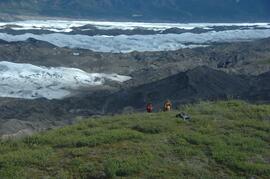
This image is part of the return trip sequence of aerial images obtained on the helicopter flight leaving the Klutlan Glacier study site. On the return leg at the end of the day, the flight initially went upvalley to pick up another party.

2023.2.2.13.2.25 · Item · 8 Jul. 2007
Part of Dr. Paul Sanborn fonds

This image is part of the outbound sequence of aerial images obtained on the helicopter flight to the Klutlan Glacier study site. The sequence starts from the base camp at the White River crossing on the Alaska Highway and heads south, to a point just upvalley of the debris-covered terminus (approx. 10-15 km from Alaska border), and turning back north to the landing spot on the Generc River floodplain close to the study site (see Fig. 1 in paper).

2023.2.2.13.2.51 · Item · 9 Jul. 2007
Part of Dr. Paul Sanborn fonds

This image is part of the return trip sequence of aerial images obtained on the helicopter flight leaving the Klutlan Glacier study site. On the return leg at the end of the day, the flight initially went upvalley to pick up another party.

2023.2.2.13.2.52 · Item · 9 Jul. 2007
Part of Dr. Paul Sanborn fonds

This image is part of the return trip sequence of aerial images obtained on the helicopter flight leaving the Klutlan Glacier study site. On the return leg at the end of the day, the flight initially went upvalley to pick up another party.

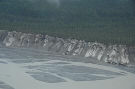
West side of Generc River
2023.2.2.13.2.10 · Item · 8 Jul. 2007
Part of Dr. Paul Sanborn fonds

This image is part of the outbound sequence of aerial images obtained on the helicopter flight to the Klutlan Glacier study site. The sequence starts from the base camp at the White River crossing on the Alaska Highway and heads south, to a point just upvalley of the debris-covered terminus (approx. 10-15 km from Alaska border), and turning back north to the landing spot on the Generc River floodplain close to the study site (see Fig. 1 in paper).

West Pine Apartments
1996.8.4.45 · File · 1981
Part of Chander Suri fonds

File consists of correspondence and investor information from Central Equities Ltd. regarding the Westpine Apartment Strata.

West Peak from Airplane
2000.1.1.3.13.54 · Item · 1978
Part of Cassiar Asbestos Corporation Ltd. fonds

Photograph depicts the West peak of the Cassiar mine, pit partially visible below. Drill visible in left foreground at highest elevation of mine, north west mountain range in background.

West Peak from Airplane
2000.1.1.3.13.55 · Item · 1978
Part of Cassiar Asbestos Corporation Ltd. fonds

Photograph depicts the West peak of the Cassiar mine, pit partially visible below. Mining equipment barely visible in foreground at highest elevation of mine, north west mountain range stands in background, and mine valley crosses midground.

West Lake Looking North
2002.17.1.03 · Item · [between 1912 and 1914]
Part of Henderson-Roe collection

Photograph depicts a view of a snow-covered lake, with trees in foreground and treed hills in background. Reads on verso as follows : "West Lake looking North (3)".

West Lake Development (2F)
1996.8.1.037 · Item · 25 May 1979
Part of Chander Suri fonds

Plan produced by Central Planning and Management Consulting LTD, Prince George BC Canada. Illustrating land use plan of West Lake. The following information appears on the plan: the main plan, "Location Plan" and "Depth Contour Plan-West Lake Scale: 1"=1056'"

West Lake Development
1996.8.1.154 · Item · 25 May 1979
Part of Chander Suri fonds

3 b&w plans drafted on a tracing paper. 1. Depth Contour Plan - West Lake 2. Location Plan 3. West Lake Development. Produced by Central Planning and Management Consulting LTD. Prince George B.C. Canada. 2F. Land Use Plan Fractional N1/2 of D.L. 4228 Cariboo District Except Easterly 20 Chains.

West Front Society
1996.2.1.1.651 · File · [199-?]
Part of Brian Fawcett fonds

File contains correspondence to Brian Fawcett from Corry Wyngaarden. Includes a letter to Brian Fawcett from Corry Wyngaarden of the Western Front Society, regarding payment for permission to copy his audio type of his reading.

West Coast Writing
1996.2.6.1.09 · File · 1973
Part of Brian Fawcett fonds

File contains issue number 12 of "West Coast Writing", which contains "Work in Progress" by Fawcett, along with the work of many other poets.