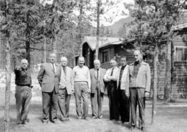
Photograph depicts group of eight men standing on lawn in front of building known as "House 130" or "Director's Lodge". Left to right: Nick Gritzuk, Charles Rainforth Elliot, W. Harold Connell, Jack Christian, Fred Martin Connell, Ken A. Creery, Plato Malezemoff (from Newmont Mining), Tam Zimmermann. Gritzuk appears to be pointing at photographer. Trees and mountains in background. Most men featured in photo are believed to be members of Cassiar's Board of Directors.
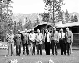
Photograph depicts group of nine men standing on lawn in front of building known as "House 130" or "Director's Lodge". Left to right: Andre Beguin, unknown, Charles Rainforth Elliot, Jack Christian, W. Harold Connell, Plato Malezemoff (from Newmont Mining), Tam Zimmermann, Ken A. Creery, Fred Martin Connell. Daffodils and tulips planted in foreground, trees and mountains in background. Most men featured in photo are believed to be members of Cassiar's Board of Directors; Beguin was a General Superintendent.
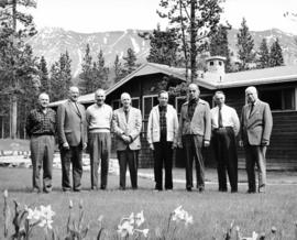
Photograph depicts group of eight men standing on lawn in front of building known as "House 130" or "Director's Lodge" (see item 2000.1.1.3.19.88). Left to right: Nick Gritzuk, Charles Rainforth Elliot, Jack Christian, W. Harold Connell, Plato Malezemoff (from Newmont Mining), Tam Zimmermann, Ken A. Creery, Fred Martin Connell. Daffodils and tulips planted in foreground, trees and mountains in background. Most men featured in photo are believed to be members of Cassiar's Board of Directors.
Photograph depicts two pick hammers laid in asbestos fibre. Annotations on note glued to recto of photograph: "ASBESTOS"; "Detail view of asbestos talus. Early test pit near top of showing. Western slope." Areas of image have been labeled "A" and "B". Photo caption under printed copy of image in 1952 Annual Report: "A - Asbestos fibre partially opened by frost action. B - Serpentine rock originally containing the asbestos fibre."
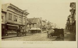
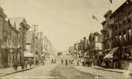
Street view of Third Avenue in Prince Rupert. One horse drawn delivery cart and one delivery car are parked on the street. Printed annotation on recto reads: "3rd Ave. Prince Rupert. B.C." Handwritten annotation on verso reads: "Book & parcel find[??] received, love & many thanks, u.w. as you know, just what I needed. [Illegible] R.W." Postcard is addressed to: "Mrs. J.W. Cawfsious [??] 1136 Barclay St. Vancouver B.C." Verso is affixed with a 2 cent Canadian Stamp, and is postmarked: "Prince Rupert B.C. Sep 19 6-PM."
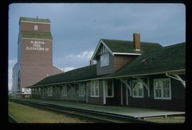
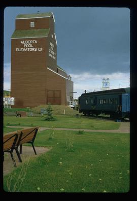
Image depicts the Station Museum and the "Alberta Pool Elevators Ltd." building in Dawson Creek, B.C.
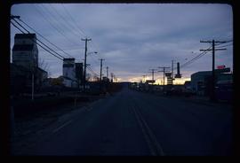
Image depicts a street of businesses and Mile "0" of the Alaskan Highway in Dawson Creek, B.C.
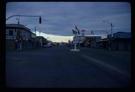
Image depicts Mile "0" of the Alaskan Highway in Dawson Creek, B.C.
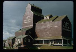
Image depicts a large building which is labelled "Alberta Pool Elevators Ltd. Dawson Creek," located in Dawson Creek, B.C.
Image depicts a large building which is labelled "Alberta Pool Elevators Ltd. Dawson Creek," located in Dawson Creek, B.C.
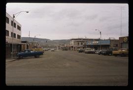
Image depicts a street of businesses in Dawson Creek, B.C.
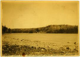
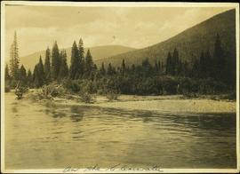
Photograph depicts the Giscome Rapids. Opposite shore in background, rocky beach in foreground. Handwritten photo caption on verso and recto of this photo reads: "Point where G.T.P. [Grand Trunk Pacific] canoe capsized at Giscome Rapids & where 3 men were drowned."
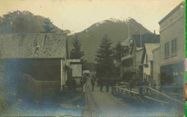
Photograph of a boardwalk street with buildings on either side, several people visible in image. Trees can be seen on street, and mountains stand in background. Handwritten annotation in pencil on verso reads: “Port Essington, North Coast Commercial Coy”.
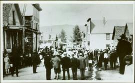
Street view of Third Avenue in Prince Rupert. A large crowd of people is gathering along the sidewalks. Printed annotation on recto reads: "Third Ave. Prince Rupert. B.C."
Handwritten annotation on verso “ Barkerville in 1930’s".
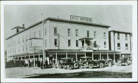
Photograph depicts hotel on corner of street, crowd and cars in foreground.
Handwritten annotation on verso “Albert Johnson’s 'Northern Hotel' South Fort George 1914".
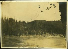
Photograph depicts a river scow in midground, close to opposite shore. Handwritten photo caption on verso and recto of this photograph reads: "In the Grand Canyon."
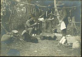
Photograph depicts four men eating and drinking at campsite, cooking and camping supplies scattered throughout. A dog sits in foreground, and many items are hung from a horizontal pole behind men. Forest trees in background.
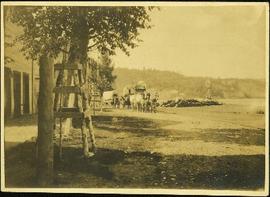
Photograph depicts men standing near three covered wagons pulled by team of horses on street. Buildings line the street on left behind trees with protective structures built around their trunks. A windmill stands near small building and woodpiles in background on right. Trees on hill are visible in distance. Handwritten annotation on recto of photograph: "Quesnel".
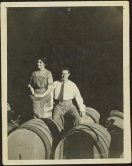
Man and woman sit on large barrels in dark area. Dog stands on right. Illegible annotation on recto of photograph: "Mr. Lev and self at Brew and [Chaisr?] Winery [Lakevill?] Cal. Sitting on '[puncheon?]' '[...?]' in the background."
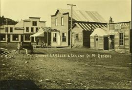
Photograph depicts a street scent at the corner of Laselle and Second St. in Fort George. A wagon is visible in the dirt road and wooden buildings cross the mid ground. Three unidentified men sit on the boardwalk outside Rigg's Restaurant while one man stands in the doorway of The White Laundry.
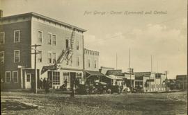
Street view of some vehicles parked in front of commercial buildings in Prince/Fort George. Businesses include "J.P. Robertson 'The Men's Store'" and "James & Co. Clothing and Shoes." Printed annotation on recto reads: "Fort George- Corner Hammond and Central."
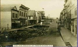
Street scene depicts people, boardwalks, and buildings with store signs. Rubble and unknown material lies on ground between boardwalks. Printed annotation on recto reads: “3rd Ave. and 6th St. Prince Rupert. B.C.”
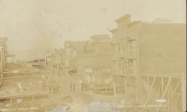
Slightly elevated street view of buildings and sidewalks being constructed in Prince Rupert, BC. Printed annotation on recto reads: "Photo by McRae Bros. Third Ave Prince Rupert, BC." Handwritten annotation on verso reads: "Dear Florence you better [illegible] will try and answer it in a few day I am well I will try and send you some cards I will stay here till in Dec Write[??] me and send me some cards I am 15 mile in the mountains Write your Bro LS Bill." Postcard is addressed to: "Miss Florence Wilson P.O. Box 1178 Worcester Mass U.S.A." A 2 cent Canadian stamp is affixed on verso. Postmark reads: "Prince Rupert BC Jul 1 10."
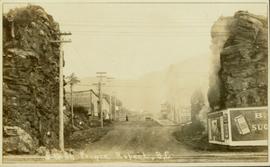
Street view of 5th St. in Prince Rupert BC. The dirt road is flanked by two partially demolished rock faces. Printed annotation on recto reads: "5th St Prince Rupert, B.C."
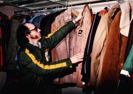
Photograph depicts man looking at coats in what appears to be the clothing section of a store.
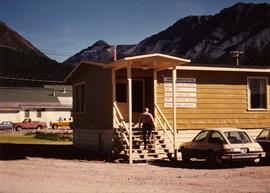
Photograph depicts unidentified man walking up front steps to building with the following sign: "TOWN ADMINISTRATION / MOTOR VEHICLE BRANCH / HCBC AGENCY / DISTRICT REGISTRAR / CDN CITIZENSHIP COURT / FISH & GAME LICENCES". Vehicles parked in foreground and behind at unknown building in midground. Power line and mountains in background.
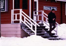
Photograph depicts unidentified man descending front steps of red building with the sign "ROYAL BANK". Snow in foreground.
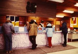
Photograph depicts unidentified men and women at counter in Royal Bank at Cassiar, B.C. Two employees stand behind counter.
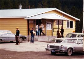
Photograph depicts unidentified men and women in front of yellow building with the signs "POST OFFCE / BUREAU DE POST / CASSIAR, B.C.", "NO PARKING". Three cars (one with siren on top) can be seen in foreground; forest in background.
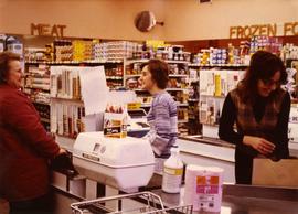
Photograph depicts three unidentified women (two behind counter) at till in grocery store. "MEAT" and FROZEN FOOD" sections visible in background.
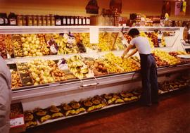
Photograph depicts unidentified man wearing apron while handling fruit in produce section of grocery store. Second individual semi-visible on far right.
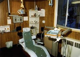
Photograph depicts examination chair and dental supplies. Winter scene visible through window in background.
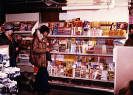
Photograph depicts three unidentified individuals browsing magazine section of store.
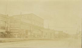
Street view photograph of several commercial buildings on an unidentified dirt road in Prince Rupert, BC. Foreground is primarily a shot of "Wallace's Dry Goods."
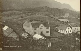
Close up photograph of a large residential building in a freshly clear cut area. To the right of the main building is the church and an unidentified commercial building. Annotation on recto reads: "Prince Rupert, BC 1660."
Photograph depicts opposite shore in background behind river, and close shore in foreground on right. Men can be seen standing and paddling on canoe in distance. Handwritten photo caption on verso and recto of this photograph reads: "On the Clearwater".
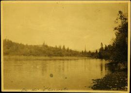
Photograph depicts opposite shore in midground behind river, tree-covered hills in background. Handwritten photo caption on verso and recto of this photograph reads: "On the Clearwater".
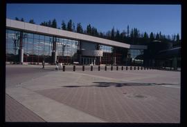
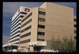
Image depicts the Prince George Civic Centre.
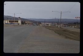
Image depicts several businesses in a small section of Chetwynd, B.C. There is a motor hotel and a half-visible sign for an Esso gas station.
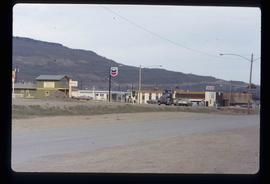
Image depicts a Chevron station as well as two motels in Chetwynd, B.C.
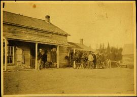
Photograph depicts four men standing near fully packed horse-drawn cart in front of wood buildings, including a long building with a porch and chairs. Trees on hill visible in background. Handwritten annotation on recto of photograph: "Changing teams on the Cariboo Road".
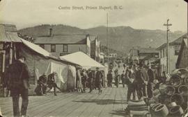
Street view of a crowd of men milling around on Centre Street in Prince Rupert, BC. Printed annotation on recto reads: "Centre Street, Prince Rupert, B.C."
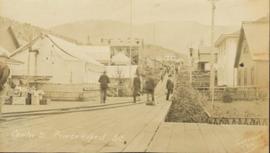
Street view of Centre Street in Prince Rupert, BC. Buildings are in various states of construction. Printed annotation on recto reads: "Centre St Prince Rupert B.C. June 20/08 JDA.""
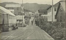
Photograph of residents in motion on Centre Street in Prince Rupert. Buildings are visible on either side of the street and a railway track runs down the length of the road. Annotation on recto reads: "Centre Street, Prince Rupert, BC. 1664."
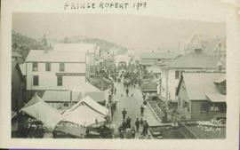
Photograph depicts crowds of people walking through street, hills in background. Printed annotation on recto reads: “Centre St. Prince Rupert May Celebrations 1909, Allen Photo July 09.” Handwritten annotation in ink on recto reads: “Prince Rupert 1909”
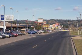
Image depicts Central Street West, parallel to Highway 97 in Prince George, B.C. looking north. Shown: Prince George Motors and other car dealerships, Burger King, Grama's Inn, and the Spruceland Shopping Mall sign. Map coordinates 53°54'42.1"N 122°46'53.1"W
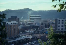
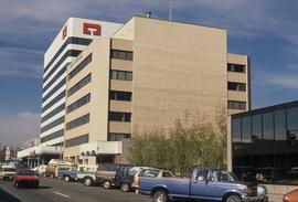
Image depicts the Central Business District of Prince George looking north from Connaught Hill. Map coordinates 53°54'41.4"N 122°44'58.5"W
Image depicts 3rd Ave at Victoria St. Map coordinates 53°55'03.9"N 122°44'54.8"W
Image depicts 3rd Ave at Victoria St. Map coordinates 53°55'03.9"N 122°44'54.8"W
