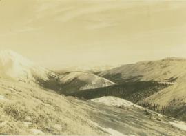
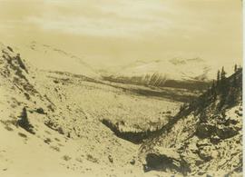
Affichage de 3093 résultats

Archival description
3093 résultats avec objets numériques Afficher les résultats avec des objets numériques
W.A.C. Bennett Dam
2012.13.1.91.02 · Pièce · Sep. 1974
Fait partie de J. Kent Sedgwick fonds

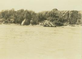
Image depicts a section of the Peace River blocked off by the W.A.C. Bennett Dam. The dam itself is not visible in the image.

2006.20.11.29 · Pièce · 9 August 1949
Fait partie de Northern BC Archives Historical Photograph Collection

Postcard overview of the Bulkley River running closely past the village of Telkwa. Handwritten annotation in pen on verso reads: "Don Choracy [?] Prince Rupert, B.C. c/o Wrathall's Photo Shop. Aug. 9 Lake Kaetlyn. We had to drive all the way to Telkwa the other nite for postcards, imagine. We were sure glad and surprised to see Jack & Dick drive in at 7 to-nite. Just like being home. We are having so much fun. The boys are out on Lake to-nite, went to visit Dr. Macdonald's me thinks. I have bad head cold so have to stay home first nite at home I've since we came, Dieks is taking me on Lake tomorrow I hope, Love Bea-P."

View South - Trees
2012.13.1.41.23 · Pièce · 2002
Fait partie de J. Kent Sedgwick fonds

Image depicts a view south, possibly of an abandoned grade for the BCR; possibly somewhere near Woodpecker, B.C.

View of Pine Pass
2012.13.1.93.55 · Pièce · 1978
Fait partie de J. Kent Sedgwick fonds

Image depicts a view of Pine Pass on the border between Alberta and British Columbia in the Rocky Mountains.

View of Downtown Prince George
2012.13.1.3.156 · Pièce · Nov. 2000
Fait partie de J. Kent Sedgwick fonds

Image depicts downtown Prince George taken from across the Nechako River looking south. Map coordinates 53°56'00.0"N 122°44'29.7"W

View from the Peace River
2000.19.2.8 · Pièce · 29 Aug. 1927-26 Sept. 1927
Fait partie de Prentiss Gray Collection

Photograph depicts a view of the Peace River leading into a strait flanked by two forested shorelines. In the background a rocky cliffside is visible.

View from Gunn Point
2012.13.1.3.060 · Pièce · Nov. 1979
Fait partie de J. Kent Sedgwick fonds

Image depicts a view of Prince George from Gunn Point in the L.C. Gunn Park looking north. Map coordinates 53°54'26.2"N 122°43'35.8"W.

View from Gunn Point
2012.13.1.3.061 · Pièce · Nov. 1979
Fait partie de J. Kent Sedgwick fonds

Image depicts a view of Prince George from Gunn Point in the L.C. Gunn Park looking north. Map coordinates 53°54'26.2"N 122°43'35.8"W.

View from Gunn Point
2012.13.1.3.059 · Pièce · Nov. 1979
Fait partie de J. Kent Sedgwick fonds

Image depicts a view of Prince George from Gunn Point in the L.C. Gunn Park looking north. Map coordinates 53°54'26.2"N 122°43'35.8"W.

View from Gunn Point
2012.13.1.3.064 · Pièce · Nov. 1979
Fait partie de J. Kent Sedgwick fonds

Image depicts a view of Prince George from Gunn Point in the L.C. Gunn Park looking north. Map coordinates 53°54'26.2"N 122°43'35.8"W.

View from Gunn Point
2012.13.1.3.065 · Pièce · Nov. 1979
Fait partie de J. Kent Sedgwick fonds

Image depicts a view of Prince George from Gunn Point in the L.C. Gunn Park looking north. Map coordinates 53°54'26.2"N 122°43'35.8"W.

View from Gunn Point
2012.13.1.3.058 · Pièce · Nov. 1979
Fait partie de J. Kent Sedgwick fonds

Image depicts a view of Prince George from Gunn Point in the L.C. Gunn Park looking north. Map coordinates 53°54'26.2"N 122°43'35.8"W.

View from Gunn Point
2012.13.1.3.062 · Pièce · Nov. 1979
Fait partie de J. Kent Sedgwick fonds

Image depicts a view of Prince George from Gunn Point in the L.C. Gunn Park looking north. Map coordinates 53°54'26.2"N 122°43'35.8"W.

View from Gunn Point
2012.13.1.3.063 · Pièce · Nov. 1979
Fait partie de J. Kent Sedgwick fonds

Image depicts a view of Prince George from Gunn Point in the L.C. Gunn Park looking north. Map coordinates 53°54'26.2"N 122°43'35.8"W.

View from Gunn Point
2012.13.1.3.066 · Pièce · Nov. 1979
Fait partie de J. Kent Sedgwick fonds

Image depicts a view of Prince George from Gunn Point in the L.C. Gunn Park looking north. Map coordinates 53°54'26.2"N 122°43'35.8"W.

View from Gunn Point
2012.13.1.3.067 · Pièce · Nov. 1979
Fait partie de J. Kent Sedgwick fonds

Image depicts a view of Prince George from Gunn Point in the L.C. Gunn Park looking north. Map coordinates 53°54'26.2"N 122°43'35.8"W.

View Down to Skagway
2012.13.1.100.23 · Pièce · 1999
Fait partie de J. Kent Sedgwick fonds

Image depicts a view over a forested, mountainous area and a river towards the vicinity of Skagway, Alaska.

View Back to Skagway
2012.13.1.100.05 · Pièce · 1999
Fait partie de J. Kent Sedgwick fonds

Image depicts a view over a forested, mountainous area and a river somewhere in the area of Skagway, Alaska.

Varves
2012.13.1.124.16 · Pièce · Oct. 1975
Fait partie de J. Kent Sedgwick fonds

Image depicts an example of varves, an annual layer of sediment or rock, with a pipe used for reference size. It is possibly located at the airport in Prince George, B.C.

Varves
2012.13.1.124.15 · Pièce · Oct. 1975
Fait partie de J. Kent Sedgwick fonds

Image depicts an example of varves, an annual layer of sediment or rock, possibly located at the airport in Prince George, B.C.