Aperçu avant impression Fermer
Affichage de 328 résultats
Archival description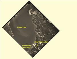
Silver City section (site Y03-11) soil charcoal samples
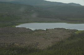
Rat Lake

Pelly River and Yukon River confluence

Pelly River and Yukon River confluence

Nostoc Crust (Kluane NP, Lower Slims)

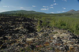
North side of Volcano Mountain

North side of Volcano Mountain

North side of Volcano Mountain

North side of Volcano Mountain

North side of Volcano Mountain

North side of Volcano Mountain

North side of the Yukon River, mid-Pleistocene basalts west of gully

Near Camp 3

Near Camp 3

Near Camp 3

Near Camp 3
Near Camp 3

Near Camp 1, facing west down the Yukon River

Mouth of Black Creek

Middle Pleistocene basalt cliffs, facing downstream between Camp 1 and Camp 2

Middle Pleistocene basalt cliffs, facing downstream between Camp 1 and Camp 2

Middle Pleistocene basalt cliffs west of Camp 2
Middle Pleistocene basalt cliffs west of Camp 2
Middle Pleistocene basalt cliffs west of Camp 2

Middle Pleistocene basalt cliffs west of Camp 2
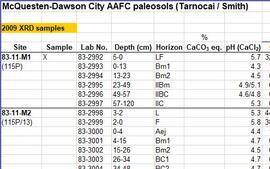
McQuesten-Dawson City paleosol data for Yukon Paleosol Study

Lower Slims unburned grassland (detail)

Lower Slims unburned grassland
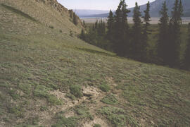
Lower Slims unburned grassland
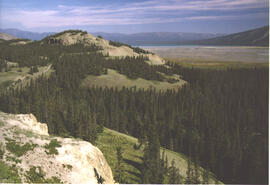
Lower Slims panorama
Lower Slims panorama

Lower Slims heavy sheep use area (detail)

Lower Slims heavy sheep use area

Lower Sheep Creek canyon
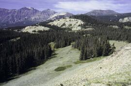
Leech Lake, south of Volcano Mountain

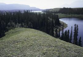
Kluane Lake soils research data
Kluane Lake 2009 field work photographs
Kluane Lake 2009 field work photographs
Kluane Lake 2004 photographs - slide roll 7
Kluane Lake 2004 photographs - slide roll 7
Kluane Lake 2004 photographs - slide roll 6
Kluane Lake 2004 photographs - slide roll 6
Kluane Lake 2004 photographs - print roll 13
Kluane Lake 2004 photographs - print roll 13
Kluane Lake 2004 photographs - print roll 12
Kluane Lake 2004 photographs - print roll 12
Kluane Lake 2004 photographs - print roll 11
Kluane Lake 2004 photographs - print roll 11
Kluane Lake 2004 photographs - print roll 10
Kluane Lake 2004 photographs - print roll 10
Kluane Lake 2003 photographs - slide roll 4
Kluane Lake 2003 photographs - slide roll 4
Kluane Lake 2003 photographs - slide roll 3
Kluane Lake 2003 photographs - slide roll 3
Kluane Lake 2003 photographs - slide roll 2
Kluane Lake 2003 photographs - slide roll 2
Kluane Lake 2003 photographs - print roll 5
Kluane Lake 2003 photographs - print roll 5
Kluane Lake 2003 photographs - print roll 4
Kluane Lake 2003 photographs - print roll 4
Kluane Lake 2003 photographs - print roll 3
Kluane Lake 2003 photographs - print roll 3
Kluane Lake 2003 photographs - digital photographs
Kluane Lake 2003 photographs - digital photographs
Ice under Dawson tephra at Gold Bottom (4)
Ice under Dawson tephra at Gold Bottom (4)