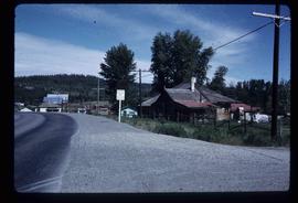
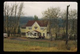
Affichage de 3025 résultats

Archival description
3025 résultats avec objets numériques Afficher les résultats avec des objets numériques
Open Field in Giscome
2012.13.1.87.069 · Pièce · [between 1975 and 1995]
Fait partie de J. Kent Sedgwick fonds

Image depicts a field in Giscome, B.C. On the right side of the image, in the background, is a grey strip that appears to be a mine, possibly the quarry at Eaglet Lake in Giscome, B.C. Map coordinates 54°03'52.9"N 122°22'10.0"W

Open Field in Giscome
2012.13.1.87.068 · Pièce · [between 1975 and 1995]
Fait partie de J. Kent Sedgwick fonds

Image depicts a field in Giscome, B.C. On the right side of the image, in the background, is a grey strip that appears to be a mine, possibly the quarry at Eaglet Lake in Giscome, B.C. Map coordinates 54°03'52.9"N 122°22'10.0"W

Open Field in Giscome
2012.13.1.87.163 · Pièce · [between 1975 and 1995]
Fait partie de J. Kent Sedgwick fonds

Image depicts an open field and Giscome, B.C. in the background. Map coordinates 54°03'52.9"N 122°22'10.0"W

Open Pit
2012.13.1.50.093 · Pièce · [1978?]
Fait partie de J. Kent Sedgwick fonds

Image depicts an open mining pit at an uncertain location; it is possibly Gibraltar.

Orchard Irrigation
2012.13.1.82.27 · Pièce · 1981
Fait partie de J. Kent Sedgwick fonds

Image depicts water flowing through an irrigation channel in an orchard, somewhere in or near Seton Portage, B.C.

Orchard Irrigation - Danger Keep Out
2012.13.1.82.28 · Pièce · 1981
Fait partie de J. Kent Sedgwick fonds

Image depicts water flowing through an irrigation channel in an orchard, somewhere in or near Seton Portage, B.C. There is a sign which reads: "Danger Keep out."

Origin of Yellowhead Highway
2012.13.1.85.49 · Pièce · Oct. 2004
Fait partie de J. Kent Sedgwick fonds

Image depicts an old road through the trees near Yellowhead Pass. The slide labels it as the origin of the Yellowhead highway.

Original Road House - Mile 150
2012.13.1.50.011 · Pièce · 1974
Fait partie de J. Kent Sedgwick fonds

Image depicts a number of buildings at an uncertain location; the slide labels the older building in the image as potentially being the "original road house."

Oscar Peak
2012.13.1.57.24 · Pièce · 1982
Fait partie de J. Kent Sedgwick fonds

Image depicts the north aspect of Oscar Peak overlooking Lava Lake in the Nass Valley.

Oscar Peak
2012.13.1.57.25 · Pièce · 1982
Fait partie de J. Kent Sedgwick fonds

Image depicts the north aspect of Oscar Peak overlooking Lava Lake in the Nass Valley.

Outhouse?
2012.13.1.22.08 · Pièce · 1970
Fait partie de J. Kent Sedgwick fonds

Image depicts what is likely an outhouse at Island Cache.

Outside Spee-Dee Printers
2012.13.1.128.04 · Pièce · 1994
Fait partie de J. Kent Sedgwick fonds

Image depicts a group of individuals on the sidewalk outside Spee-Dee Printers on Brunswick Street in Prince George, B.C.

Paddlewheel Park
2012.13.1.7.202 · Pièce · Nov. 2000
Fait partie de J. Kent Sedgwick fonds

Image depicts the Fraser River at Paddlewheel park, with a train on the other side of the river, in Prince George B.C.

Paddlewheel Park
2012.13.1.7.201 · Pièce · Nov. 2000
Fait partie de J. Kent Sedgwick fonds

Image depicts the Fraser River at Paddlewheel park, with a train on the other side of the river, in Prince George B.C.

Parking Lot Frisbee
2012.13.1.93.18 · Pièce · 1979
Fait partie de J. Kent Sedgwick fonds

Image depicts a group of people throwing a frisbee in a parking lot at an uncertain location, likely in the Peace River Region.

2012.13.1.87.004 · Pièce · [between 1975 and 1995]
Fait partie de J. Kent Sedgwick fonds

Image depicts several eighteen wheelers at the Pass Lake Road and Upper Fraser Road intersection with numerous houses and buildings in the background in McGregor, B.C. Map coordinates 54°04'38.1"N 121°50'00.1"W

Pat's Pass
2012.13.1.79.18 · Pièce · Aug. 1977
Fait partie de J. Kent Sedgwick fonds

Image depicts a view of a valley; the slide itself labels the image in two places, "central basin" on the left side of the image, and "Pat's Pass" on the top of the image between the two mountains.

Paul Aivazoff's Capitol Theatre
2012.13.1.6.278 · Pièce · [198-?]
Fait partie de J. Kent Sedgwick fonds

Image depicts an old theatre owned by Paul Aivazoff in Prince Rupert, B.C. It opened in 1935 and was closed in 1981; it has since been renovated for retail use.

Peace River
2012.13.1.91.12 · Pièce · Oct. 1978
Fait partie de J. Kent Sedgwick fonds

Image depicts the Peace River, possibly near Clayhurst or Hudson's Hope, B.C.

Peace River
2012.13.1.91.13 · Pièce · Oct. 1978
Fait partie de J. Kent Sedgwick fonds

Image depicts the Peace River, possibly near Clayhurst or Hudson's Hope, B.C.

Peace River?
2012.13.1.91.06 · Pièce · Oct. 1978
Fait partie de J. Kent Sedgwick fonds

Image depicts what is possibly the Peace River running parallel to a road, possibly Highway 29.

Peace River
2012.13.1.91.23 · Pièce · Oct. 1978
Fait partie de J. Kent Sedgwick fonds

Image depicts the Peace River, possibly near Hudson's Hope, B.C.

Peace River
2012.13.1.93.27 · Pièce · 1978
Fait partie de J. Kent Sedgwick fonds

Image depicts the Peace River and visible layers of sediment deposits in the surrounding cliffs.

Peace River
2012.13.1.93.36 · Pièce · 1978
Fait partie de J. Kent Sedgwick fonds

Image depicts the Peace River, possibly somewhere near Fort St. John, B.C.