Community Life

Elements area

Taxonomy

Code

Scope note(s)

  • Municipalities, towns, villages, neighbourhoods, religious and cultural groups, camps, schools, etc.
  • Community activities and events
  • Groups working for the development or maintenance of events, services and facilities for the community and its promotion
  • Community support and charitable organizations
  • Community booster and event promotion agencies
  • Fraternal organizations
  • SEE ALSO: Family and Personal Life; Events and Celebrations

Source note(s)

  • MemoryBC Subject Groups

Display note(s)

    Hierarchical terms

    Community Life

      Equivalent terms

      Community Life

        Associated terms

        Community Life

          2016 Archival description results for Community Life

          2016 results directly related Exclude narrower terms
          Cassiar Staff
          2000.1.1.3.28 · File · 1990
          Part of Cassiar Asbestos Corporation Ltd. fonds

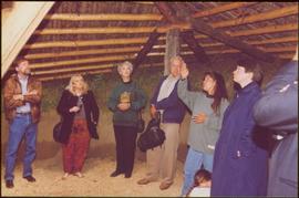
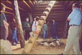
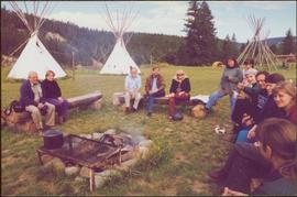
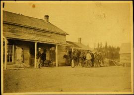
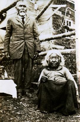
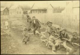
          Photographs of various Cassiar Staff at work. There is extensive annotations on the back of each photo explaining who is depicted and where they are working.

          2000.1.1.3.13.04 · Item · [before 1970]
          Part of Cassiar Asbestos Corporation Ltd. fonds

          Photograph depicts the Cassiar townsite behind shadow in foreground. Plantsite can be seen including the mill, dry rock storage building, tailings pile, and many other buildings. Mountains in background. Handwritten annotation on recto: "<- 13 1/2" ->". (This photograph was made into a promotional poster.)

          2009.5.2.58 · Item · [ca. 1913]
          Part of Taylor-Baxter Family Photograph Collection

          Photograph depicts Catholic church, with rectory on its left, and First United Church behind. A wood boardwalk crosses midground, and a man can be seen riding a bicycle near church. Power lines and rough cleared land in foreground, hills and mountains in background. Handwritten annotation on recto of photograph: "Church in Rupert."

          2012.13.3.1.26 · File · 1990-2010
          Part of J. Kent Sedgwick fonds

          File consists of notes, clippings, and reproductions relating to Catholic churches in Prince George. File consists of material on the Sacred Heart Catholic Church at 887 Patricia Boulevard in Prince George; St. Fredricks Catholic Church in Giscome; and St. Joseph's Chapel at 1088 Gillett Street in Prince George. File predominantly includes printed photographs from The Exploration Place Museum database depicting various catholic churches in Prince George; and "St Joseph's Church" printed email from the Prince George Diocese Archives to Kent Sedgwick (17 Mar. 2010). Also includes photographs depicting a house at the address 1705 Fir Street in Prince George (2006).

          Cecil Nicholls
          2003.11.1.32 · File · 1999-2000
          Part of Island Cache Recovery Project Collection

          File consists of an oral history given by Cecil Nicholls, which was gathered as part of Dr. Mike Evan's Island Cache Recovery Project. Includes consent forms, transcripts, and the recorded oral history on the original media.

          2011.3.2.09 · Item · 1913
          Part of North Coast & Central BC Postcard Collection

          Printed annotation on recto reads: “Central Avenue Fort George B.C. Copyright Canada June 25th 1913”. Handwritten annotation in ink on recto reads: “Hotel Fort George; Pool room; Men’s furnishing; General store; Bank Vancouver; Telephone office; Temperance House; Trust-company; Grand stand & fair grounds; Hospital; Ware house and general store.” Cancelled 1 cent Canadian stamp on verso is dated: "Fort George BC Jul 14 13". Handwritten message in ink on verso is addressed to Mr. Chas H Wilson 94 Gould St Toronto: "Fort George. B.C> Box 65, July 13/ 13. Dear Father, This is a 'bird's eye view' of our main street - ha! ha! some class alright. We live right behind the bakery lunch room on the right hand side of the picture, on 1st avenue, some people eh? Will be moving to Cassiar Ave soon. How are all the folks. Mae is writing. Peace. M."

          2012.13.3.1.10 · File · 1966-2006
          Part of J. Kent Sedgwick fonds

          File consists of clippings, notes, and reproductions relating to the central business district of Prince George. Includes: "Tours of downtown" pamphlet from the Prince George Public Library (6 July 2006); "Mr. P.G. says welcome to the city of Prince George" promotional map from the City of Prince George and drawn by H. Kettner (1966); "Re: Pcl. A (Lots 19-20)" typescript letter from BC Rail to Kent Sedgwick (2 Dec. 1987); "Prince George Public Library" letter from Tom Dielissen at the Prince George Public Library to Kent Sedgwick (2 July 1997); "Town Centre Historical Project" letter to the Mayor and Council of Prince George from Daniel Guerrette (16 July 1981); and "Historical continuity and the proposed town centre" typescript document submitted to City Council from the Heritage Advisory Committee (July 1981). File also includes photographs depicting the industrial area of Prince George (1987).

          Central Fort George townsite
          2012.13.2.03.02 · File · 1993-2011
          Part of J. Kent Sedgwick fonds

          File consists of clippings, notes, and reproductions relating to the Central Fort George townsite. File predominantly includes Kent Sedgwick's handwritten notes regarding land plots and development of Central Fort George. Includes: a map depicting Canadian National Railway plans along Hammond Street and the Fraser River (1936) and "Central Fort George lots" map depicting lot plans for the Central Fort George townsite (reproduced 1990).

          2009.7.1.300 · Item · 1 July 1909
          Part of Archdeacon W. H. Collison fonds

          Photograph of Centre Street in Prince Rupert on Dominion Day. The Union Bank of Canada is located on the left side of the street, and a decorative arch can be seen in the background. Annotation on recto reads: "Centre Sr. Prince Rupert Dominion Day Celebrations 1909 Allen Photo July 09."

          Centre Street Prince Rupert
          2009.7.1.251 · Item · ca. 1880-1920
          Part of Archdeacon W. H. Collison fonds

          Photograph of residents in motion on Centre Street in Prince Rupert. Buildings are visible on either side of the street and a railway track runs down the length of the road. Annotation on recto reads: "Centre Street, Prince Rupert, BC. 1664."

          2009.6.1.553 · Item · [1992?]
          Part of The Honourable Iona Campagnolo fonds

          Left to right: Charles Jago and unidentified woman, David Fish, Dennis Macknak, Deborah Poff, unidentified woman and child, Iona Campagnolo, Lee Morrison, Ellen Facey, two unidentified women. Teepees visible in background. Photograph was taken during the chancellor's tour of Xats'ull Heritage Village, Soda Creek First Nation, Williams Lake, B.C.

          2009.5.3.24 · Item · [ca. 1914]
          Part of Taylor-Baxter Family Photograph Collection

          Photograph depicts four men standing near fully packed horse-drawn cart in front of wood buildings, including a long building with a porch and chairs. Trees on hill visible in background. Handwritten annotation on recto of photograph: "Changing teams on the Cariboo Road".

          Charles Millar
          2012.13.3.1.42 · File · 1988-2004
          Part of J. Kent Sedgwick fonds

          File consists of notes, clippings, and reproductions relating to Charles Millar and the Millar Addition in Prince George.

          Chester Jeffery
          2003.11.1.17 · File · 1999-2000
          Part of Island Cache Recovery Project Collection

          File consists of an oral history given by Chester Jeffery, which was gathered as part of Dr. Mike Evan's Island Cache Recovery Project. Includes consent forms, transcripts, and the recorded oral history on the original media.

          2012.13.2.18.07 · File · 2003-2007
          Part of J. Kent Sedgwick fonds

          File consists of notes, clippings, and reproductions relating to Chilako River and Indian Reserve No. 4. File contains material regarding the discovery of Indigenous artifacts in an archaeological dig by faculty and students from the University of Northern British Columbia; the establishment of a fur trading fort at Chala-oo-chick for the Hudson's Bay Company; and Indian Reserve No. 4 of the L'heidli T'enneh. Includes photographs depicting Fernie Ollinger's barn on Chilako Station Road and Chilako River (2006).

          Children at play
          2009.7.1.164 · Item · [ca. 1910]
          Part of Archdeacon W. H. Collison fonds

          Seven young boys enjoying a game of tug-a-war alongside a wooden track. Track runs along a picket fence through a village. A small girl watches the fun from the sidelines and older woman carries a basket in the background. Handwritten annotation in pen on verso reads: “Native children at play”.

          2009.7.1.056 · Item · [between 1874 and 1901]
          Part of Archdeacon W. H. Collison fonds

          Several unidentified individuals can be seen on front steps of church and a group of small children in white stand in line below steps. Other community buildings are visible in background, white fence crosses foreground. Photograph depicts the first church built in Metlakatla, which was burned in a fire in 1901, and replaced in 1903.

          Handwritten annotation on verso reads: "Church (of England) at Metlakahtla - British Columbia. Built by the people of the village - largest church then on the pacific coast."

          2009.7.1.057 · Item · [between 1874 and 1901]
          Part of Archdeacon W. H. Collison fonds

          Several unidentified individuals can be seen on front steps of church and a group of small children in white stand in line below steps. Other community buildings are visible in background, white fence crosses foreground. Photograph depicts the first church built in Metlakatla, which was burned in a fire in 1901, and replaced in 1903.

          Handwritten annotation on verso reads: "Old church at Metlakatla Before fire. Built by Fr. Duncan & the village people".

          2009.5.3.29 · Item · [ca. 1912]
          Part of Taylor-Baxter Family Photograph Collection

          Photograph depicts two men standing in street at the Fort George Reserve. A church with steeple stands in midground, on left side of street. Forest in background. Handwritten annotation on verso and recto of this photograph reads: "Fort George Temple." See item 2009.5.3.28 for photograph depicting this reserve which belonged to the Lheidli T'enneh Band.

          2023.5.1.29 · Item · 1 Nov. 1993
          Part of UNBC School of Planning and Sustainability fonds

          This map is part of Schedule B of the 1993 Official Community Plan, Bylaw No. 5909 for the City of Prince George. This particular map depicts the northeast area of the City of Prince George, including the industrial areas on Prince George Pulpmill Road and Northwood Pulpmill Road along the Fraser River.

          2012.13.2.15.01 · File · 1986-2000
          Part of J. Kent Sedgwick fonds

          File consists of notes, reproductions, clippings, and letters relating to the Junkers aircraft named "The City of Prince George," registration CF-ALX. Includes: "Western Canada Aviation Museum" letter to Dennis McCallum from Karen Schmidt (25 June 1986) and "City of Prince George Junkers F-13 Airplane" typescript document (4 Sept. 1986).